Waterway information

Kind:
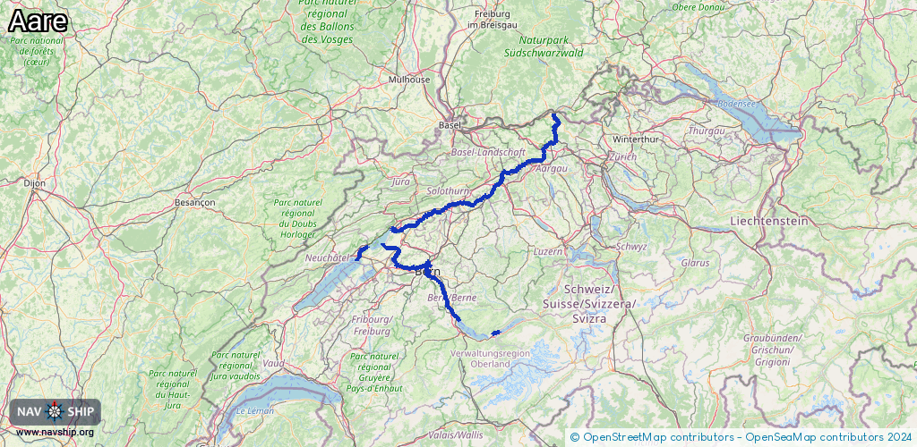
Inland
Driving areas:
🇨🇭 Switzerland
Length:
216 km¹
¹River kilometers or bank length recorded in NavShip, including river arms and harbor entrances.
Availability:
Completely recorded
Recent Update: 25.01.2024²
² This date indicates when an adjustment last took place in the course of the body of water
Recorded:
Locks: 1
Harbours / marinas: 8
Bridges: 0
Berths: 0
Slipways: 2
Fuelstations: 0
Route:
Please wait, loading route graphic...
Request waterway overview map with symbol legend here (Link).
Information about data associated with this body of water (11 available):
Data by OpenSeaMap (c) OSM contributors, www.openseamap.org
| # | Kind | Coordinates | Name | Information |
|---|---|---|---|---|
| 1 | Marina | 46.96738,7.36245 | 2023-02-02T22:27:23Z | |
| 2 | Marina | 46.96688,7.36011 | 2023-02-02T22:27:23Z | |
| 3 | Marina | 46.96973,7.29896 | 2023-02-02T22:27:23Z | |
| 4 | Marina | 46.97067,7.29806 | 2023-02-02T22:27:23Z | |
| 5 | Marina | 47.13092,7.23319 | 2025-06-30T21:01:34Z | Kleinbootshafen |
| 6 | Marina | 47.05199,7.07545 | 2025-03-19T17:31:05Z | Le Landeron |
| 7 | Marina | 46.69422,7.88207 | 2024-11-08T19:48:30Z | |
| 8 | Marina | 46.76606,7.6006 | 2021-08-24T18:28:53Z | Yachtclub for the nobles [email protected] https://yachtclub-nobles.business.sit e/ |
| 9 | Slipway | 47.12816,7.23434 | small_craft_facility | 2017-08-15T07:29:36Z |
| 10 | Slipway | 46.92536,7.47056 | small_craft_facility | 2014-07-29T11:08:15Z by car |
| 11 | Lock | 47.1184,7.25694 | Schleuse Port | +41323316116 |