Waterway information

Kind:
Lower
Driving areas:
🇳🇱 Netherlands
Length:
7 km¹
¹River kilometers or bank length recorded in NavShip, including river arms and harbor entrances.
Availability:
Completely recorded
Recent Update: 27.07.2022²
² This date indicates when an adjustment last took place in the course of the body of water
Recorded:
Locks: 0
Harbours / marinas: 1
Bridges: 7
Berths: 0
Slipways: 0
Fuelstations: 0
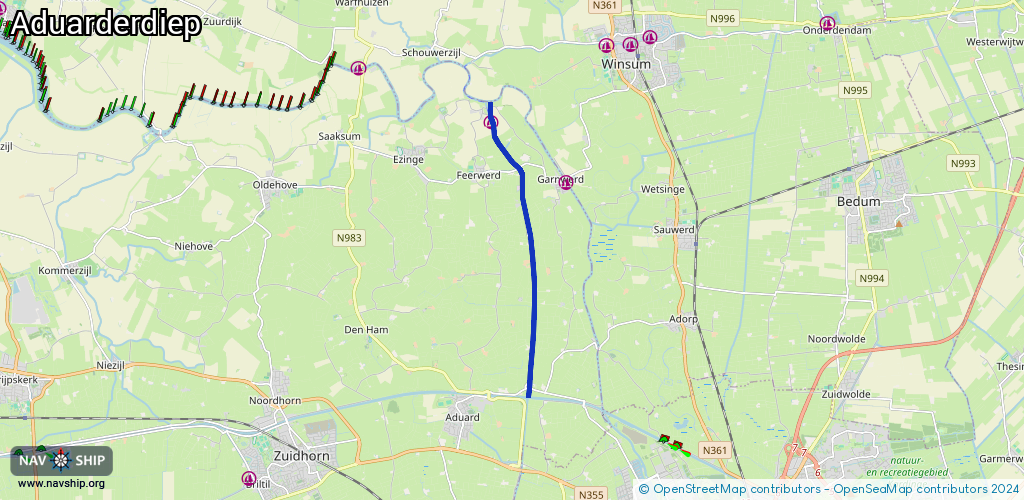
Route:
Please wait, loading route graphic...
Request waterway overview map with symbol legend here (Link).
Information about data associated with this body of water (8 available):
Data by OpenSeaMap (c) OSM contributors, www.openseamap.org
| # | Kind | Coordinates | Name | Information |
|---|---|---|---|---|
| 1 | Marina | 53.31648,6.46998 | 2022-06-05T13:14:04Z | Jachthaven Aduarderzijl [email protected] +31 594 621 836 https://www.aduarderzijl.com/?page_id=14 |
| 2 | Bridge | 53.26186,6.48297 | 12.35 | Clearance height: 2013-04-04T15:30:18Z m Maximum passage width: 4.84 m Movable bridge (e.g. lifting bridge or drawbridge) fixed |
| 3 | Bridge | 53.27036,6.484 | 6.60 | Clearance height: 2013-02-19T16:13:10Z m Maximum passage width: 3.20 m Movable bridge (e.g. lifting bridge or drawbridge) fixed |
| 4 | Bridge | 53.29341,6.48304 | 6 | Clearance height: 2013-02-19T16:13:10Z m Maximum passage width: 3.20 m Movable bridge (e.g. lifting bridge or drawbridge) fixed |
| 5 | Bridge | 53.30702,6.47941 | 13 | Clearance height: 2013-02-19T16:13:10Z m Maximum passage width: 3.10 m Movable bridge (e.g. lifting bridge or drawbridge) fixed |
| 6 | Bridge | 53.30692,6.4787 | Unknown | Clearance height: 2013-02-28T14:27:49Z m Maximum passage width: 3.1 m fixed |
| 7 | Bridge | 53.31988,6.4696 | 6 | Clearance height: 2018-11-21T23:40:02Z m Maximum passage width: 3.47 m Movable bridge (e.g. lifting bridge or drawbridge) fixed |
| 8 | Bridge | 53.31934,6.46861 | 6 | Clearance height: 2020-06-19T18:31:22Z m Maximum passage width: 3.4 m Movable bridge (e.g. lifting bridge or drawbridge) fixed |