Waterway information

Kind:
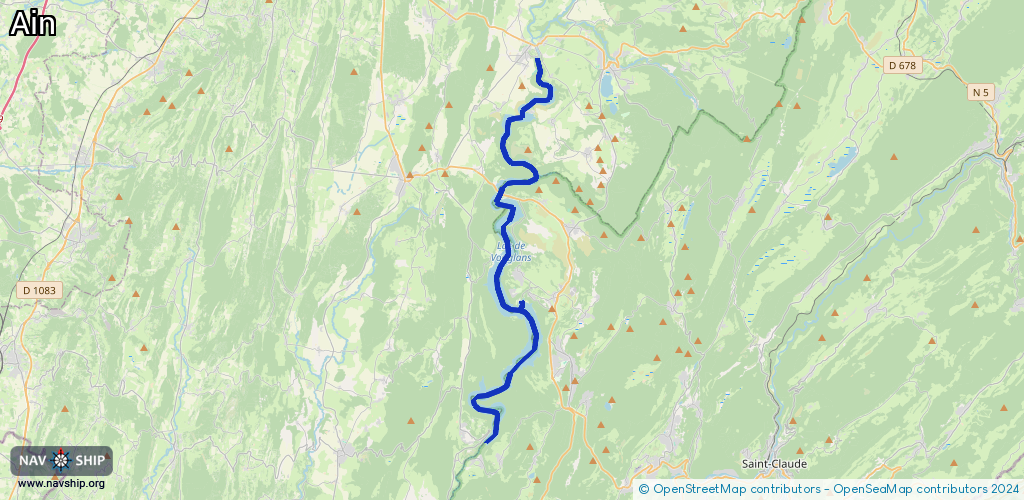
Inland
Driving areas:
🇫🇷 France
Length:
30.3 km¹
¹River kilometers or bank length recorded in NavShip, including river arms and harbor entrances.
Availability:
Completely recorded
Recent Update: 03.01.2024²
² This date indicates when an adjustment last took place in the course of the body of water
Recorded:
Locks: 0
Harbours / marinas: 3
Bridges: 0
Berths: 0
Slipways: 0
Fuelstations: 0
Route:
Please wait, loading route graphic...
Request waterway overview map with symbol legend here (Link).
Information about data associated with this body of water (3 available):
Data by OpenSeaMap (c) OSM contributors, www.openseamap.org
| # | Kind | Coordinates | Name | Information |
|---|---|---|---|---|
| 1 | Marina | 46.46316,5.68936 | 2025-03-25T09:01:53Z | Port de la Mercantine +33 3 84 42 03 32 http://www.ports-vouglans.com/fr/port-lac-vouglans-site-officiel.php#lac-vouglans.php |
| 2 | Marina | 46.51967,5.67284 | 2025-08-10T17:25:37Z | Le Port du Meix +33 3 84 25 49 59 http://www.ports-vouglans.com/fr/port-lac-vouglans-site-officiel.php#lac-vouglans.php |
| 3 | Marina | 46.57877,5.70118 | 2021-02-27T16:36:33Z | Port de la Saisse +33 3 84 44 77 35 http://www.ports-vouglans.com/fr/port-lac-vouglans-site-officiel.php#lac-vouglans.php |