Waterway information

Kind:
Inland
Driving areas:
🇯🇵 Japan🌊 Pacific Ocean
Length:
15 km¹
¹River kilometers or bank length recorded in NavShip, including river arms and harbor entrances.
Availability:
Completely recorded
Recent Update: 01.04.2025²
² This date indicates when an adjustment last took place in the course of the body of water
Recorded:
Locks: 0
Harbours / marinas: 0
Bridges: 0
Berths: 5
Slipways: 0
Fuelstations: 0
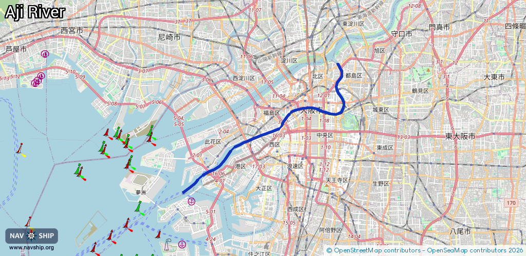
Route:
Please wait, loading route graphic...
Request waterway overview map with symbol legend here (Link).
Information about data associated with this body of water (5 available):
Data by OpenSeaMap (c) OSM contributors, www.openseamap.org
| # | Kind | Coordinates | Name | Information |
|---|---|---|---|---|
| 1 | Berth | 34.65982,135.43047 | 2018-11-08T22:56:33Z | M.13 |
| 2 | Berth | 34.65804,135.42625 | 2018-11-08T22:56:33Z | 17 |
| 3 | Berth | 34.65853,135.4276 | 2018-11-08T22:56:33Z | 15 |
| 4 | Berth | 34.65754,135.42487 | 2018-11-08T22:56:33Z | 19 |
| 5 | Berth | 34.66017,135.41023 | 2018-10-05T05:33:36Z | HS.3 |