Waterway information

Kind:
Sea
Driving areas:
🌊 Baltic Sea🇩🇰 Denmark
Length:
47.8 km¹
¹River kilometers or bank length recorded in NavShip, including river arms and harbor entrances.
Availability:
Completely recorded
Recent Update: 08.04.2025²
² This date indicates when an adjustment last took place in the course of the body of water
Recorded:
Locks: 0
Harbours / marinas: 13
Bridges: 0
Berths: 0
Slipways: 0
Fuelstations: 0
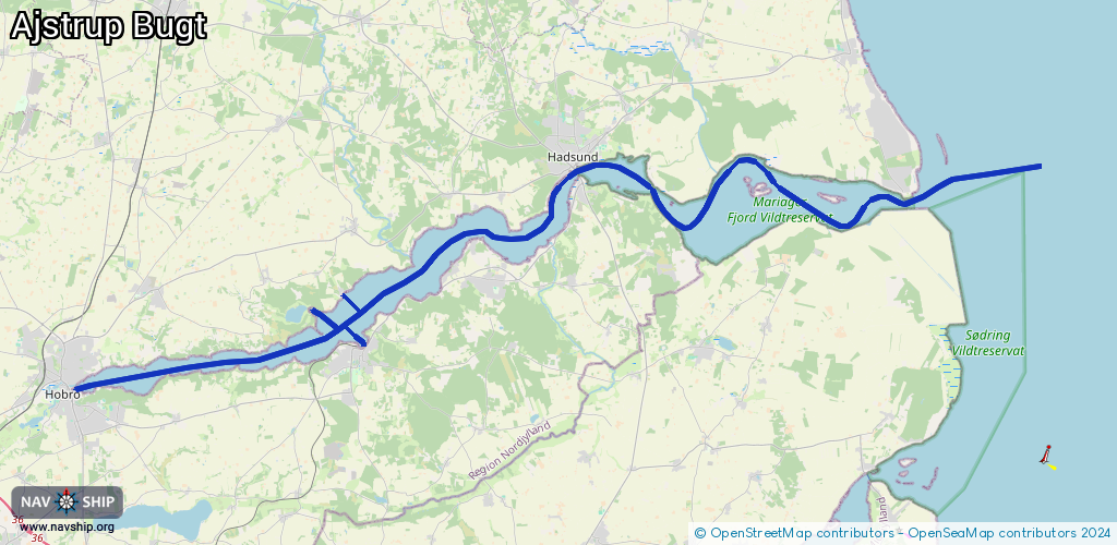
Route:
Please wait, loading route graphic...
Request waterway overview map with symbol legend here (Link).
Information about data associated with this body of water (13 available):
Data by OpenSeaMap (c) OSM contributors, www.openseamap.org
| # | Kind | Coordinates | Name | Information |
|---|---|---|---|---|
| 1 | Marina | 56.63852,9.80629 | 2024-02-19T07:40:36Z | Hobro Både- og Fiskerihavn |
| 2 | Marina | 56.64351,9.81197 | 2024-02-19T07:40:36Z | Hobro Lystbådehavn |
| 3 | Marina | 56.63709,9.84051 | 2024-02-19T13:03:47Z | Ørndalens Bådelaug |
| 4 | Marina | 56.69883,10.0446 | 2025-02-15T09:15:17Z | Vive Havn https://www.vive-havn.dk/ |
| 5 | Marina | 56.68394,10.0725 | 2025-07-31T10:12:18Z | Kongsdal Lystbådehavn |
| 6 | Marina | 56.7097,10.10517 | 2024-02-19T11:13:07Z | Hadsund Lystbådehavn |
| 7 | Marina | 56.71117,10.11605 | 2024-03-02T12:07:14Z | Færgehagen |
| 8 | Marina | 56.71675,10.12573 | 2024-02-19T11:13:07Z | Hadsund Fiskerihavn |
| 9 | Marina | 56.70517,10.32863 | 2024-02-20T17:30:04Z | Als Odde Bro |
| 10 | Marina | 56.66588,9.95301 | 2024-02-19T09:36:27Z | Høllet |
| 11 | Marina | 56.65319,9.98229 | 2024-02-19T08:38:49Z | Mariager Jollehavn |
| 12 | Marina | 56.65407,9.98309 | 2024-02-19T08:38:49Z | Mariager Lystbådehavn |
| 13 | Marina | 56.67131,9.97032 | 2024-02-19T10:47:48Z | Stinesminde Havn |