Waterway information

Kind:
Inland
Driving areas:
🌊 Pacific Ocean🇺🇸 United States of America
Length:
8.4 km¹
¹River kilometers or bank length recorded in NavShip, including river arms and harbor entrances.
Availability:
Completely recorded
Recent Update: 20.11.2023²
² This date indicates when an adjustment last took place in the course of the body of water
Recorded:
Locks: 0
Harbours / marinas: 3
Bridges: 0
Berths: 3
Slipways: 0
Fuelstations: 0
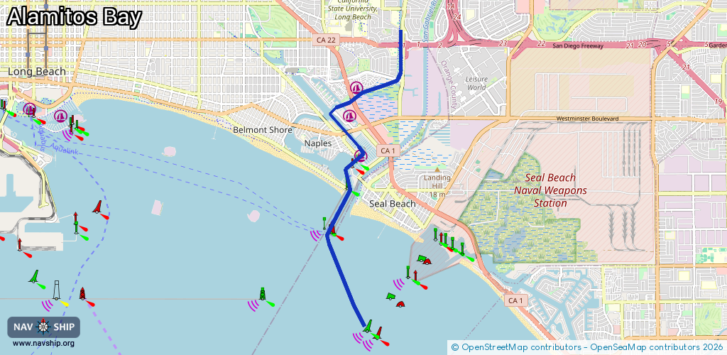
Route:
Please wait, loading route graphic...
Request waterway overview map with symbol legend here (Link).
Information about data associated with this body of water (6 available):
Data by OpenSeaMap (c) OSM contributors, www.openseamap.org
| # | Kind | Coordinates | Name | Information |
|---|---|---|---|---|
| 1 | Marina | 33.7659,-118.11452 | 2025-12-24T06:39:43Z | Cerritos Bahia Marina |
| 2 | Marina | 33.76021,-118.11621 | 2025-12-25T01:41:10Z | Marina Pacifica |
| 3 | Marina | 33.75178,-118.11342 | 2025-12-24T06:36:12Z | Alamitos Bay Marina +1 562-570-3215 https://www.longbeach.gov/park/marine/marinas/alamitos-bay-marina |
| 4 | Berth | 33.74893,-118.11587 | 2025-12-24T06:48:24Z | Berth 1 |
| 5 | Berth | 33.74847,-118.11576 | 2025-12-24T06:48:24Z | Berth 2 |
| 6 | Berth | 33.74806,-118.11566 | 2025-12-24T06:48:24Z | Berth 3 |