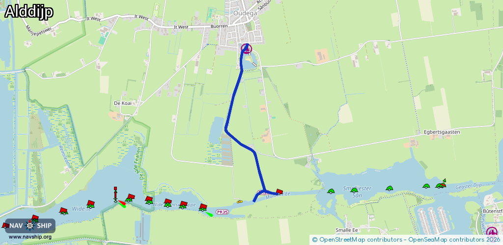
Waterway information

Kind:
Inland
Driving areas:
🇳🇱 Netherlands
Length:
2.3 km¹
¹River kilometers or bank length recorded in NavShip, including river arms and harbor entrances.
Availability:
Completely recorded
Recent Update: 04.04.2024²
² This date indicates when an adjustment last took place in the course of the body of water
Recorded:
Locks: 0
Harbours / marinas: 1
Bridges: 0
Berths: 1
Slipways: 0
Fuelstations: 0
Route:
Please wait, loading route graphic...
Request waterway overview map with symbol legend here (Link).
Information about data associated with this body of water (2 available):
Data by OpenSeaMap (c) OSM contributors, www.openseamap.org
| # | Kind | Coordinates | Name | Information |
|---|---|---|---|---|
| 1 | Marina | 53.12258,6.00079 | 2025-09-03T11:15:46Z | Jachthaven Alddjip +31 6 53 70 35 08 https://www.oudega.inf o/jachthaven-oudega/ |
| 2 | Berth | 53.10741,6.00328 | 2023-11-21T00:33:16Z | PR34 |