Waterway information

Kind:
Inland
Driving areas:
🇨🇭 Switzerland
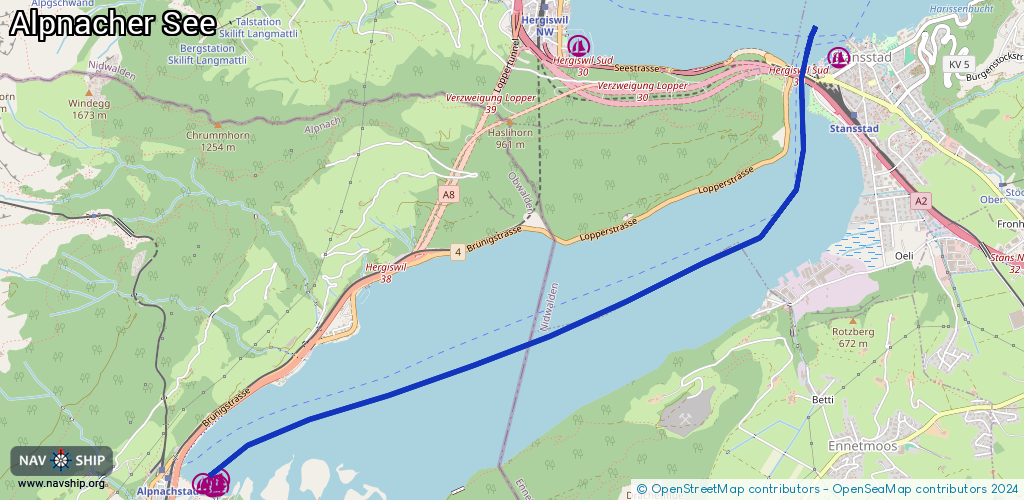
Length:
5.4 km¹
¹River kilometers or bank length recorded in NavShip, including river arms and harbor entrances.
Availability:
Completely recorded
Recent Update: 16.05.2023²
² This date indicates when an adjustment last took place in the course of the body of water
Recorded:
Locks: 0
Harbours / marinas: 5
Bridges: 0
Berths: 0
Slipways: 0
Fuelstations: 0
Route:
Please wait, loading route graphic...
Request waterway overview map with symbol legend here (Link).
Information about data associated with this body of water (5 available):
Data by OpenSeaMap (c) OSM contributors, www.openseamap.org
| # | Kind | Coordinates | Name | Information |
|---|---|---|---|---|
| 1 | Marina | 46.97978,8.33544 | 2023-11-04T09:58:14Z | Bootshafen Stansstad [email protected] +41 41 6104769 https://www.stansstad.ch/de/tourismus/gemeindebootshafen/ |
| 2 | Marina | 46.95492,8.28217 | 2022-07-07T04:28:08Z | |
| 3 | Marina | 46.95475,8.28078 | 2022-07-07T04:26:49Z | |
| 4 | Marina | 46.95456,8.28207 | 2022-07-07T04:28:08Z | |
| 5 | Marina | 46.95443,8.28165 | 2022-07-07T04:28:08Z |