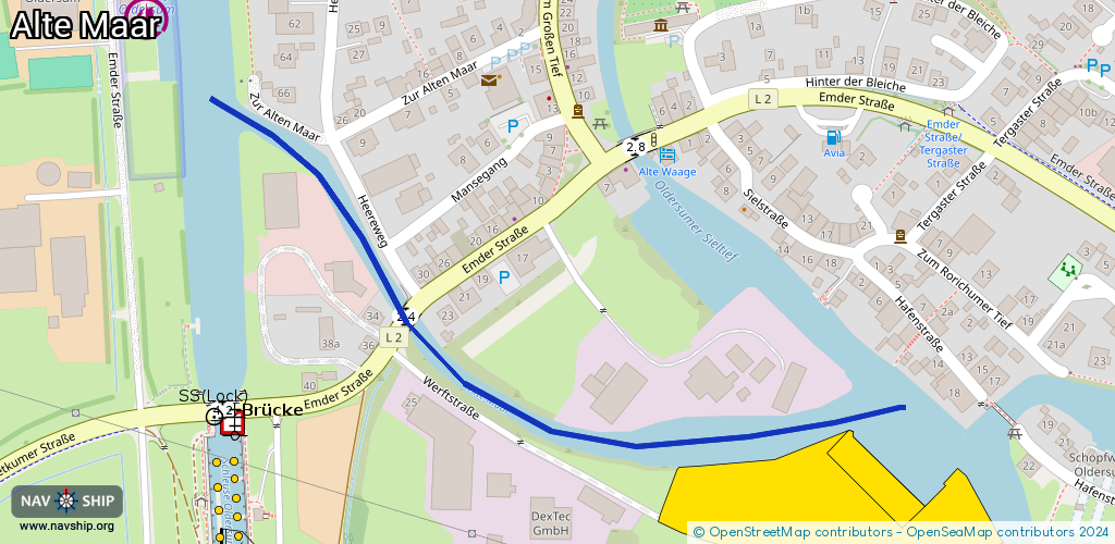
Waterway information

Kind:
Inland
Driving areas:
🇩🇪 Germany
Length:
0.6 km¹
¹River kilometers or bank length recorded in NavShip, including river arms and harbor entrances.
Availability:
Completely recorded
Recent Update: 10.01.2023²
² This date indicates when an adjustment last took place in the course of the body of water
Recorded:
Locks: 0
Harbours / marinas: 1
Bridges: 1
Berths: 0
Slipways: 2
Fuelstations: 0
Route:
Please wait, loading route graphic...
Request waterway overview map with symbol legend here (Link).
Information about data associated with this body of water (4 available):
Data by OpenSeaMap (c) OSM contributors, www.openseamap.org
| # | Kind | Coordinates | Name | Information |
|---|---|---|---|---|
| 1 | Marina | 53.3252,7.34135 | 2021-04-14T18:11:05Z | Schiffswerft Diedrich https://www.schiffswerft-diedrich.de/ |
| 2 | Bridge | 53.32651,7.33691 | Unknown | Clearance height: 2015-06-20T09:31:25Z m Maximum passage width: 2.4 m fixed |
| 3 | Slipway | 53.3252,7.34135 | shoreline_construction | 2021-04-14T18:11:05Z Schiffswerft Diedrich |
| 4 | Slipway | 53.3256,7.34155 | shoreline_construction | 2020-07-02T21:25:48Z |