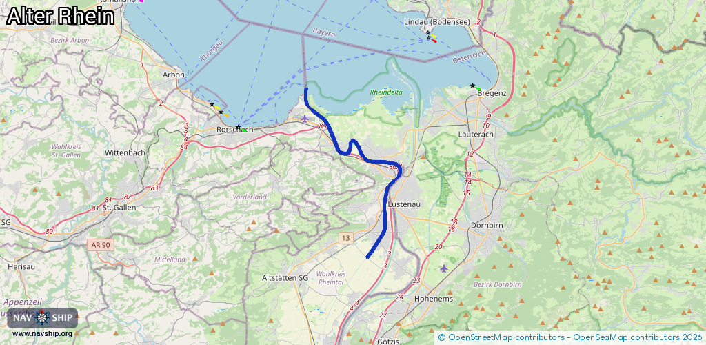
Waterway information

Kind:
Inland
Driving areas:
🇦🇹 Austria🇨🇭 Switzerland
Length:
19.4 km¹
¹River kilometers or bank length recorded in NavShip, including river arms and harbor entrances.
Availability:
Completely recorded
Recent Update: 29.07.2024²
² This date indicates when an adjustment last took place in the course of the body of water
Recorded:
Locks: 0
Harbours / marinas: 6
Bridges: 1
Berths: 0
Slipways: 0
Fuelstations: 0
Route:
Please wait, loading route graphic...
Request waterway overview map with symbol legend here (Link).
Information about data associated with this body of water (7 available):
Data by OpenSeaMap (c) OSM contributors, www.openseamap.org
| # | Kind | Coordinates | Name | Information |
|---|---|---|---|---|
| 1 | Marina | 47.4648,9.59399 | 2022-09-12T21:44:48Z | Schiffsanlegestelle |
| 2 | Marina | 47.46439,9.59471 | 2022-09-12T21:44:48Z | Bootshafen Zoll |
| 3 | Marina | 47.47356,9.58869 | 2022-09-12T21:44:48Z | Privater Bootshafen |
| 4 | Marina | 47.48119,9.58411 | 2022-09-12T21:44:48Z | Bootshafen Schiffle |
| 5 | Marina | 47.48008,9.58478 | 2022-09-12T21:44:48Z | Bootshafen Yachtklub Wetterwinkel |
| 6 | Marina | 47.47903,9.58426 | 2021-08-04T13:18:57Z | |
| 7 | Bridge | 47.46459,9.59392 | Unknown | Clearance height: 2014-04-07T12:27:19Z m fixed |