Waterway information

Kind:
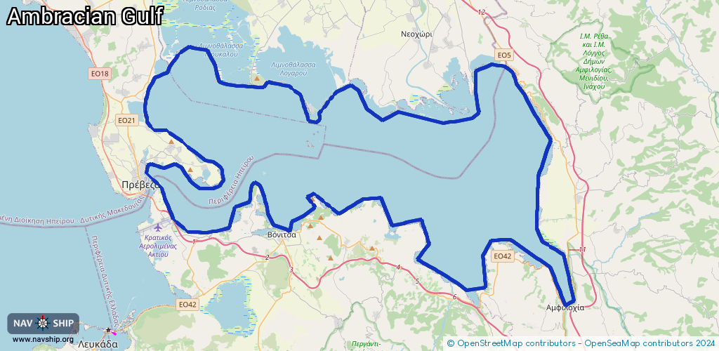
Lake
Driving areas:
🇬🇷 Greece🌊 Sea Mediterranean
Length:
147.3 km¹
¹River kilometers or bank length recorded in NavShip, including river arms and harbor entrances.
Availability:
Completely recorded
Recent Update: 24.09.2025²
² This date indicates when an adjustment last took place in the course of the body of water
Recorded:
Locks: 0
Harbours / marinas: 17
Bridges: 0
Berths: 1
Slipways: 0
Fuelstations: 0
Route:
Please wait, loading route graphic...
Request waterway overview map with symbol legend here (Link).
Information about data associated with this body of water (18 available):
Data by OpenSeaMap (c) OSM contributors, www.openseamap.org
| # | Kind | Coordinates | Name | Information |
|---|---|---|---|---|
| 1 | Marina | 38.99654,20.77272 | 2019-06-15T01:06:05Z | |
| 2 | Marina | 38.96375,20.79933 | 2019-10-07T21:24:17Z | |
| 3 | Marina | 38.97121,20.78865 | 2019-10-07T21:35:52Z | |
| 4 | Marina | 38.9736,20.7561 | 2022-05-30T10:53:11Z | |
| 5 | Marina | 38.92197,20.88531 | 2022-06-15T07:08:05Z | |
| 6 | Marina | 38.93342,20.94016 | 2022-01-22T20:18:41Z | Βαρκό Παλιαμπέλων |
| 7 | Marina | 38.92273,20.99433 | 2019-06-18T19:50:50Z | EN |
| 8 | Marina | 38.89516,21.02722 | 2019-10-07T19:34:42Z | |
| 9 | Marina | 38.90499,21.11239 | 2021-08-05T19:01:19Z | Molos |
| 10 | Marina | 38.86902,21.16246 | 2022-08-22T17:55:46Z | Μαρίνα Αμφιλοχίας-Gulf Marina |
| 11 | Marina | 39.04277,21.07773 | 2019-06-17T23:10:52Z | |
| 12 | Marina | 39.03827,21.07614 | 2019-06-17T23:10:52Z | Kopraina |
| 13 | Marina | 39.01307,21.00273 | 2019-06-17T23:23:53Z | |
| 14 | Marina | 39.01473,20.91317 | 2019-06-17T23:34:33Z | Koronisia |
| 15 | Marina | 39.03102,20.87026 | 2019-06-19T02:04:49Z | Salaoras |
| 16 | Marina | 39.03208,20.8607 | 2019-06-17T23:35:31Z | |
| 17 | Marina | 39.01925,20.7553 | 2019-06-15T01:22:47Z | |
| 18 | Berth | 39.03102,20.87026 | 2019-06-19T02:04:49Z | Salaoras |