Waterway information

Kind:
Inland
Driving areas:
🇺🇸 United States of America
Length:
13.1 km¹
¹River kilometers or bank length recorded in NavShip, including river arms and harbor entrances.
Availability:
Completely recorded
Recent Update: 04.03.2025²
² This date indicates when an adjustment last took place in the course of the body of water
Recorded:
Locks: 0
Harbours / marinas: 7
Bridges: 0
Berths: 0
Slipways: 0
Fuelstations: 1
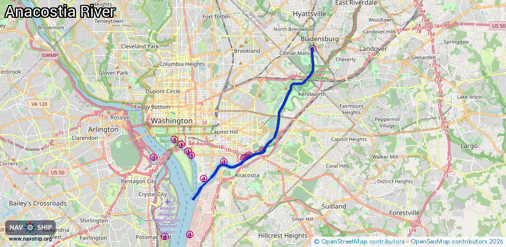
Route:
Please wait, loading route graphic...
Request waterway overview map with symbol legend here (Link).
Information about data associated with this body of water (8 available):
Data by OpenSeaMap (c) OSM contributors, www.openseamap.org
| # | Kind | Coordinates | Name | Information |
|---|---|---|---|---|
| 1 | Marina | 38.93367,-76.93852 | 2022-05-07T12:34:29Z | |
| 2 | Marina | 38.87902,-76.97382 | 2025-10-03T01:44:44Z | Seafarer's Yacht Club |
| 3 | Marina | 38.87631,-76.9832 | 2025-10-04T01:25:58Z | Washington Yacht Club +1 202-543-2027 |
| 4 | Marina | 38.87466,-76.98681 | 2024-12-07T21:55:43Z | Eastern Powerboat Club +1 202-543-5890 |
| 5 | Marina | 38.87527,-76.98563 | 2024-12-07T21:55:43Z | District Yacht Club https://districtyachtclub.org/ |
| 6 | Marina | 38.87266,-77.00052 | 2024-02-18T21:14:31Z | The Yards Marina +1 202-484-0309 https://www.theyardsmarina.com |
| 7 | Marina | 38.86372,-77.01421 | 2024-09-15T17:56:57Z | James Creek Marina +1 202-554-8844 https://boatingindc.com/james-creek-marina/ |
| 8 | Fuel station | 38.86239,-77.01383 | 2023-02-10T09:41:10Z |