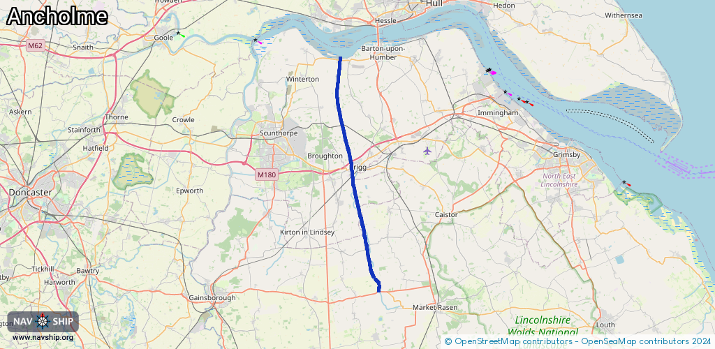
Waterway information

Kind:
Inland
Driving areas:
🇬🇧 United Kingdom
Length:
31.3 km¹
¹River kilometers or bank length recorded in NavShip, including river arms and harbor entrances.
Availability:
Completely recorded
Recent Update: 10.02.2025²
² This date indicates when an adjustment last took place in the course of the body of water
Recorded:
Locks: 1
Harbours / marinas: 1
Bridges: 1
Berths: 0
Slipways: 0
Fuelstations: 0
Route:
Please wait, loading route graphic...
Request waterway overview map with symbol legend here (Link).
Information about data associated with this body of water (3 available):
Data by OpenSeaMap (c) OSM contributors, www.openseamap.org
| # | Kind | Coordinates | Name | Information |
|---|---|---|---|---|
| 1 | Marina | 53.67611,-0.52539 | 2025-02-01T23:48:58Z | South Ferriby Marina Mo-Fr 09:00-17:00, Sa-Su,PH 10:00-16:30 [email protected] +44 1652 635620 https://thesouthferribymarina.co.uk |
| 2 | Bridge | 53.67699,-0.52527 | Unknown | Clearance height: 2023-09-26T21:42:21Z m Movable bridge (e.g. lifting bridge or drawbridge) lifting |
| 3 | Lock | 53.43636,-0.46591 | Unknown |