Waterway information

Kind:
Inland
Driving areas:
🇳🇱 Netherlands
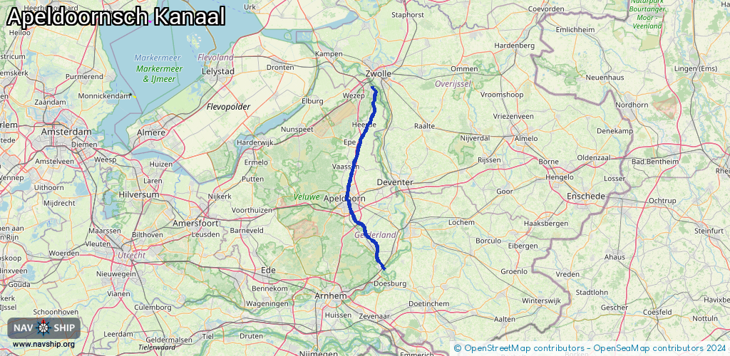
Length:
54.2 km¹
¹River kilometers or bank length recorded in NavShip, including river arms and harbor entrances.
Availability:
Completely recorded
Recent Update: 04.03.2025²
² This date indicates when an adjustment last took place in the course of the body of water
Recorded:
Locks: 6
Harbours / marinas: 0
Bridges: 1
Berths: 0
Slipways: 1
Fuelstations: 0
Route:
Please wait, loading route graphic...
Request waterway overview map with symbol legend here (Link).
Information about data associated with this body of water (8 available):
Data by OpenSeaMap (c) OSM contributors, www.openseamap.org
| # | Kind | Coordinates | Name | Information |
|---|---|---|---|---|
| 1 | Bridge | 52.47459,6.07266 | Unknown | Clearance height: 2020-11-25T18:44:59Z m bascule |
| 2 | Slipway | 52.47765,6.06945 | small_craft_facility | 2021-04-23T18:12:43Z |
| 3 | Lock | 52.24317,5.97693 | Unknown | |
| 4 | Lock | 52.29801,5.99953 | Unknown | |
| 5 | Lock | 52.38157,6.04838 | Unknown | |
| 6 | Lock | 52.45664,6.07798 | Unknown | |
| 7 | Lock | 52.05017,6.11325 | Unknown | |
| 8 | Lock | 52.22074,5.97275 | Unknown |