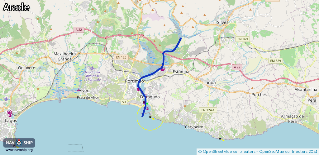
Waterway information

Kind:
Inland
Driving areas:
🌊 Atlantic Ocean🇵🇹 Portugal
Length:
10.4 km¹
¹River kilometers or bank length recorded in NavShip, including river arms and harbor entrances.
Availability:
Completely recorded
Recent Update: 19.06.2023²
² This date indicates when an adjustment last took place in the course of the body of water
Recorded:
Locks: 0
Harbours / marinas: 3
Bridges: 0
Berths: 2
Slipways: 1
Fuelstations: 1
Route:
Please wait, loading route graphic...
Request waterway overview map with symbol legend here (Link).
Information about data associated with this body of water (7 available):
Data by OpenSeaMap (c) OSM contributors, www.openseamap.org
| # | Kind | Coordinates | Name | Information |
|---|---|---|---|---|
| 1 | Marina | 37.14815,-8.50598 | 2021-05-24T16:39:01Z | |
| 2 | Marina | 37.1308,-8.53249 | 2024-01-20T10:05:50Z | |
| 3 | Marina | 37.11889,-8.52606 | 2017-10-19T15:22:24Z | |
| 4 | Slipway | 37.1361,-8.52806 | small_craft_facility | 2018-10-27T11:59:48Z |
| 5 | Berth | 37.12449,-8.52407 | 2017-10-19T15:22:24Z | |
| 6 | Berth | 37.11318,-8.52268 | 2017-10-19T15:22:24Z | |
| 7 | Fuel station | 37.1211,-8.52651 | 2023-05-27T11:20:48Z |