Waterway information

Kind:
Inland
Driving areas:
🇮🇹 Italy🌊 Sea Mediterranean
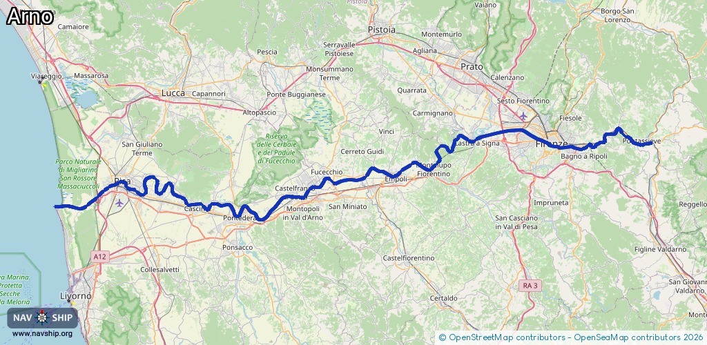
Length:
127 km¹
¹River kilometers or bank length recorded in NavShip, including river arms and harbor entrances.
Availability:
Completely recorded
Recent Update: 15.08.2023²
² This date indicates when an adjustment last took place in the course of the body of water
Recorded:
Locks: 0
Harbours / marinas: 1
Bridges: 0
Berths: 3
Slipways: 4
Fuelstations: 1
Route:
Please wait, loading route graphic...
Request waterway overview map with symbol legend here (Link).
Information about data associated with this body of water (9 available):
Data by OpenSeaMap (c) OSM contributors, www.openseamap.org
| # | Kind | Coordinates | Name | Information |
|---|---|---|---|---|
| 1 | Marina | 43.6779,10.27135 | 2024-04-20T17:09:13Z | Porto di Pisa Boccadarno https://www.portodipisa.it/ |
| 2 | Slipway | 43.67964,10.29134 | small_craft_facility | 2025-10-01T05:41:36Z |
| 3 | Slipway | 43.6797,10.28796 | small_craft_facility | 2025-10-01T05:41:36Z |
| 4 | Slipway | 43.67954,10.28352 | small_craft_facility | 2023-07-20T10:28:49Z |
| 5 | Slipway | 43.67967,10.28624 | small_craft_facility | 2025-10-01T05:41:36Z |
| 6 | Berth | 43.67742,10.27401 | 2022-05-13T22:25:20Z | check name |
| 7 | Berth | 43.67762,10.27301 | 2022-05-13T22:25:20Z | D |
| 8 | Berth | 43.67746,10.27043 | 2022-05-13T22:25:20Z | A |
| 9 | Fuel station | 43.67843,10.27073 | 2022-05-13T22:25:20Z |