Waterway information

Kind:
Inland
Driving areas:
🌊 Atlantic Ocean🇺🇸 United States of America
Length:
13.9 km¹
¹River kilometers or bank length recorded in NavShip, including river arms and harbor entrances.
Availability:
Completely recorded
Recent Update: 23.01.2024²
² This date indicates when an adjustment last took place in the course of the body of water
Recorded:
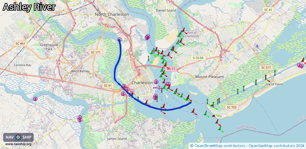
Locks: 0
Harbours / marinas: 5
Bridges: 2
Berths: 1
Slipways: 0
Fuelstations: 0
Route:
Please wait, loading route graphic...
Request waterway overview map with symbol legend here (Link).
Information about data associated with this body of water (8 available):
Data by OpenSeaMap (c) OSM contributors, www.openseamap.org
| # | Kind | Coordinates | Name | Information |
|---|---|---|---|---|
| 1 | Marina | 32.77885,-79.95171 | 2025-09-20T01:55:39Z | Safe Harbor Marina +1-843-723-5098 https://www.charleston-sc.com/city-marina.html |
| 2 | Marina | 32.77745,-79.96247 | 2021-03-02T05:32:28Z | |
| 3 | Marina | 32.78174,-79.95642 | 2025-05-23T02:01:35Z | Ashley Marina +1-843-722-1996 |
| 4 | Marina | 32.78565,-79.95795 | 2026-01-23T23:01:18Z | Safe Harbor Bristol +1-843-723-6600 https://shmarinas.com/locations/safe-harbor-bristol |
| 5 | Marina | 32.82998,-79.96569 | 2024-09-02T03:40:11Z | Dolphin Cove Marina |
| 6 | Bridge | 32.77911,-79.95656 | 33.5 | Clearance height: 2025-07-26T21:44:44Z m Maximum passage width: 17 m Movable bridge (e.g. lifting bridge or drawbridge) fixed |
| 7 | Bridge | 32.77965,-79.95694 | 33.5 | Clearance height: 2025-07-26T21:44:44Z m Maximum passage width: 17 m Movable bridge (e.g. lifting bridge or drawbridge) fixed |
| 8 | Berth | 32.76433,-79.8899 | 2021-04-07T03:22:51Z | Lower Middle Ground Anchorage Lighted Buoy L anchorage |