Waterway information

Kind:
Inland
Driving areas:
🇸🇪 Sweden
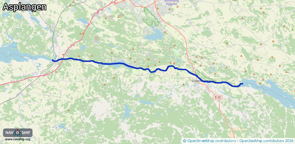
Length:
28.8 km¹
¹River kilometers or bank length recorded in NavShip, including river arms and harbor entrances.
Availability:
Completely recorded
Recent Update: 01.04.2025²
² This date indicates when an adjustment last took place in the course of the body of water
Recorded:
Locks: 6
Harbours / marinas: 0
Bridges: 3
Berths: 0
Slipways: 0
Fuelstations: 0
Route:
Please wait, loading route graphic...
Request waterway overview map with symbol legend here (Link).
Information about data associated with this body of water (9 available):
Data by OpenSeaMap (c) OSM contributors, www.openseamap.org
| # | Kind | Coordinates | Name | Information |
|---|---|---|---|---|
| 1 | Bridge | 58.49058,16.30493 | Unknown | Clearance height: 2022-08-02T17:21:28Z m |
| 2 | Bridge | 58.49247,16.29519 | Unknown | Clearance height: 2022-08-02T17:21:28Z m |
| 3 | Bridge | 58.49477,16.28938 | Unknown | Clearance height: 2025-11-09T14:33:02Z m |
| 4 | Lock | 58.49465,16.28966 | Unknown | |
| 5 | Lock | 58.49653,16.28344 | Unknown | |
| 6 | Lock | 58.49663,16.2789 | Unknown | |
| 7 | Lock | 58.49676,16.27367 | Unknown | |
| 8 | Lock | 58.49688,16.26848 | Unknown | |
| 9 | Lock | 58.49413,16.2001 | Unknown |