Waterway information

Kind:
Inland
Driving areas:
🌊 Atlantic Ocean🇺🇸 United States of America
Length:
19.9 km¹
¹River kilometers or bank length recorded in NavShip, including river arms and harbor entrances.
Availability:
Completely recorded
Recent Update: 06.05.2025²
² This date indicates when an adjustment last took place in the course of the body of water
Recorded:
Locks: 0
Harbours / marinas: 9
Bridges: 0
Berths: 0
Slipways: 0
Fuelstations: 0
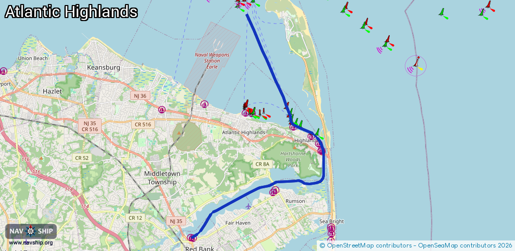
Route:
Please wait, loading route graphic...
Request waterway overview map with symbol legend here (Link).
Information about data associated with this body of water (9 available):
Data by OpenSeaMap (c) OSM contributors, www.openseamap.org
| # | Kind | Coordinates | Name | Information |
|---|---|---|---|---|
| 1 | Marina | 40.35303,-74.07037 | 2022-08-20T20:59:57Z | |
| 2 | Marina | 40.35243,-74.06868 | 2022-08-23T23:46:21Z | |
| 3 | Marina | 40.37658,-74.01423 | 2020-05-19T21:33:26Z | Barnacle Bills Marina |
| 4 | Marina | 40.3776,-74.01258 | 2020-05-19T21:33:26Z | Oceanic Marina |
| 5 | Marina | 40.39849,-73.98129 | 2023-10-09T00:46:24Z | Gateway Marina |
| 6 | Marina | 40.3977,-73.98114 | 2020-12-21T21:02:31Z | |
| 7 | Marina | 40.40168,-73.98306 | 2020-12-21T21:02:31Z | |
| 8 | Marina | 40.40553,-73.98808 | 2020-12-21T21:02:31Z | |
| 9 | Marina | 40.41058,-74.00019 | 2020-05-19T21:33:26Z | Sandy Hook Bay Marina |