Waterway information

Kind:
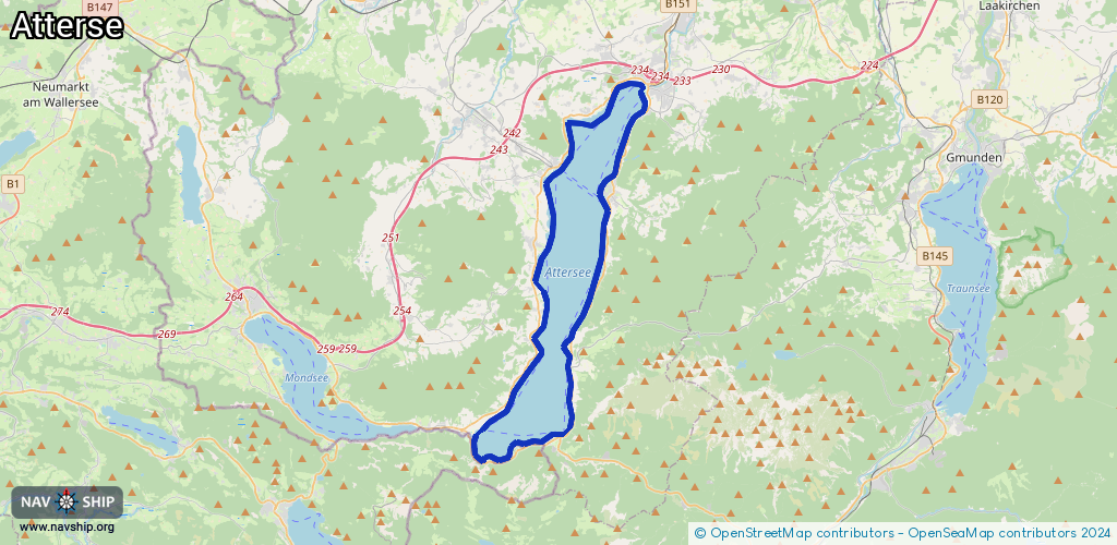
Lake
Driving areas:
🇦🇹 Austria
Length:
49.5 km¹
¹River kilometers or bank length recorded in NavShip, including river arms and harbor entrances.
Availability:
Completely recorded
Recent Update: 22.02.2026²
² This date indicates when an adjustment last took place in the course of the body of water
Recorded:
Locks: 0
Harbours / marinas: 11
Bridges: 0
Berths: 0
Slipways: 3
Fuelstations: 0
Route:
Please wait, loading route graphic...
Request waterway overview map with symbol legend here (Link).
Information about data associated with this body of water (14 available):
Data by OpenSeaMap (c) OSM contributors, www.openseamap.org
| # | Kind | Coordinates | Name | Information |
|---|---|---|---|---|
| 1 | Marina | 47.94733,13.59298 | 2021-03-21T15:11:51Z | Marina Schloßteich |
| 2 | Marina | 47.93545,13.55941 | 2021-09-06T09:41:45Z | Segelclub Kammersee |
| 3 | Marina | 47.90716,13.52841 | 2021-03-21T15:11:51Z | UYCAs |
| 4 | Marina | 47.80424,13.48988 | 2021-03-21T00:24:11Z | |
| 5 | Marina | 47.94517,13.59245 | 2021-03-21T15:11:51Z | Marina Kammer |
| 6 | Marina | 47.94406,13.59278 | 2021-03-21T15:11:51Z | Motor Yacht Club Salzkammergut |
| 7 | Marina | 47.90107,13.5662 | 2025-08-07T11:26:27Z | |
| 8 | Marina | 47.87685,13.56671 | 2021-03-21T16:15:28Z | SVW-YS |
| 9 | Marina | 47.87635,13.56739 | 2018-01-20T09:35:17Z | |
| 10 | Marina | 47.84058,13.54369 | 2022-08-23T19:36:36Z | |
| 11 | Marina | 47.84051,13.54388 | 2021-03-21T16:15:28Z | SSVS |
| 12 | Slipway | 47.9109,13.53223 | small_craft_facility | 2013-05-12T15:21:59Z |
| 13 | Slipway | 47.87656,13.5667 | small_craft_facility | 2018-01-08T14:13:04Z Slipanlage by car |
| 14 | Slipway | 47.87663,13.56675 | small_craft_facility | 2018-01-08T14:13:04Z Kran crane |