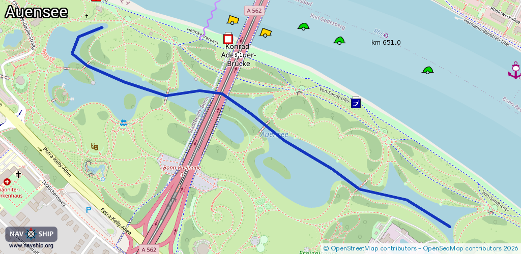
Waterway information

Kind:
Lower
Driving areas:
🇩🇪 Germany
Length:
1.4 km¹
¹River kilometers or bank length recorded in NavShip, including river arms and harbor entrances.
Availability:
Completely recorded
Recent Update: 15.01.2024²
² This date indicates when an adjustment last took place in the course of the body of water
Recorded:
Locks: 0
Harbours / marinas: 0
Bridges: 1
Berths: 0
Slipways: 0
Fuelstations: 0
Route:
Please wait, loading route graphic...
Request waterway overview map with symbol legend here (Link).
Information about data associated with this body of water (1 available):
Data by OpenSeaMap (c) OSM contributors, www.openseamap.org
| # | Kind | Coordinates | Name | Information |
|---|---|---|---|---|
| 1 | Bridge | 50.71522,7.1417 | 39.2 | Clearance height: 2026-02-07T11:47:52Z m Maximum passage width: 9.1 m Movable bridge (e.g. lifting bridge or drawbridge) Rhein km 651,38, DH amtlich: 17,40m minus Kölner Pegel, Gemessen mittels Segelmast: 18,13m minus Kölner Pegel |