Waterway information

Kind:
Inland
Driving areas:
🇫🇮 Finland
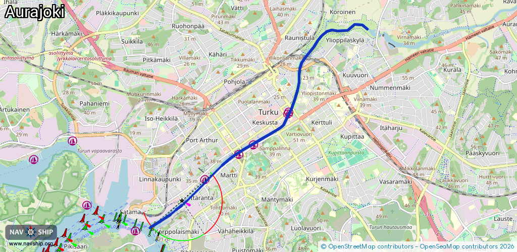
Length:
6 km¹
¹River kilometers or bank length recorded in NavShip, including river arms and harbor entrances.
Availability:
Completely recorded
Recent Update: 22.06.2023²
² This date indicates when an adjustment last took place in the course of the body of water
Recorded:
Locks: 0
Harbours / marinas: 5
Bridges: 0
Berths: 6
Slipways: 0
Fuelstations: 0
Route:
Please wait, loading route graphic...
Request waterway overview map with symbol legend here (Link).
Information about data associated with this body of water (11 available):
Data by OpenSeaMap (c) OSM contributors, www.openseamap.org
| # | Kind | Coordinates | Name | Information |
|---|---|---|---|---|
| 1 | Marina | 60.45152,22.27387 | 2022-03-26T11:34:58Z | |
| 2 | Marina | 60.45127,22.27359 | 2022-03-26T11:34:58Z | |
| 3 | Marina | 60.44603,22.26175 | 2022-11-12T17:53:51Z | |
| 4 | Marina | 60.44449,22.25701 | 2021-07-07T08:54:41Z | |
| 5 | Marina | 60.44051,22.24595 | 2022-05-16T10:04:07Z | Turku Aurajoki +358 2 230 9194 https://www.turunvierasvenesatama.fi/ |
| 6 | Berth | 60.43478,22.23306 | 2021-07-05T13:33:13Z | TKU 12 |
| 7 | Berth | 60.43432,22.23191 | 2021-07-05T13:33:13Z | TKU 12 |
| 8 | Berth | 60.43385,22.23076 | 2021-07-05T13:33:13Z | TKU 11 |
| 9 | Berth | 60.43337,22.22931 | 2021-07-05T13:33:13Z | TKU 10 |
| 10 | Berth | 60.43305,22.22781 | 2021-07-05T13:33:13Z | TKU 9 |
| 11 | Berth | 60.43288,22.22611 | 2021-07-05T13:33:13Z | TKU V2 |