Waterway information

Kind:
Inland
Driving areas:
🌊 Atlantic Ocean🇺🇸 United States of America
Length:
13.2 km¹
¹River kilometers or bank length recorded in NavShip, including river arms and harbor entrances.
Availability:
Completely recorded
Recent Update: 01.04.2025²
² This date indicates when an adjustment last took place in the course of the body of water
Recorded:
Locks: 0
Harbours / marinas: 8
Bridges: 0
Berths: 0
Slipways: 0
Fuelstations: 0
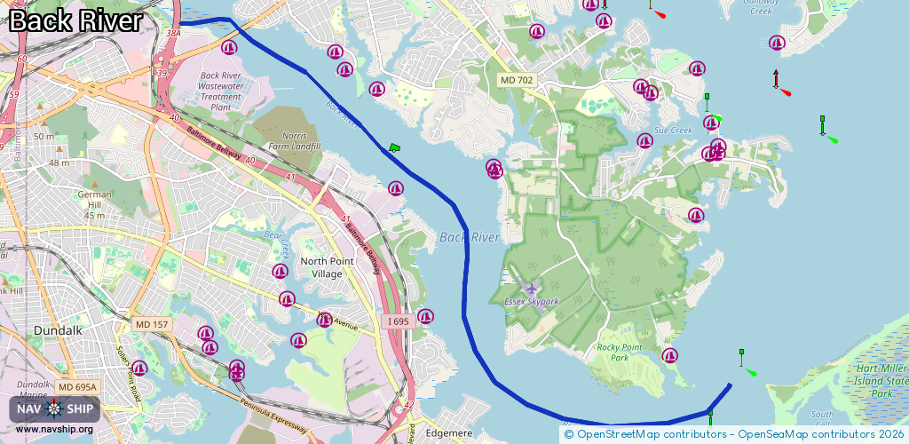
Route:
Please wait, loading route graphic...
Request waterway overview map with symbol legend here (Link).
Information about data associated with this body of water (8 available):
Data by OpenSeaMap (c) OSM contributors, www.openseamap.org
| # | Kind | Coordinates | Name | Information |
|---|---|---|---|---|
| 1 | Marina | 39.25915,-76.45279 | 2020-05-19T21:33:26Z | North Point Cove Marina |
| 2 | Marina | 39.28107,-76.43891 | 2020-05-19T21:33:26Z | |
| 3 | Marina | 39.28204,-76.43888 | 2020-05-19T21:33:26Z | West Shore Yacht Center |
| 4 | Marina | 39.27828,-76.45853 | 2020-05-19T21:33:26Z | Key Yacht Club |
| 5 | Marina | 39.29338,-76.4615 | 2025-05-19T15:03:26Z | Essex Yacht Harbor Marina +1 410 686 6634 |
| 6 | Marina | 39.29676,-76.46704 | 2020-05-19T21:33:26Z | Weaver's Marine Service |
| 7 | Marina | 39.29936,-76.46995 | 2020-05-19T21:33:26Z | Riverside Marine |
| 8 | Marina | 39.29971,-76.49084 | 2020-05-19T21:33:26Z |