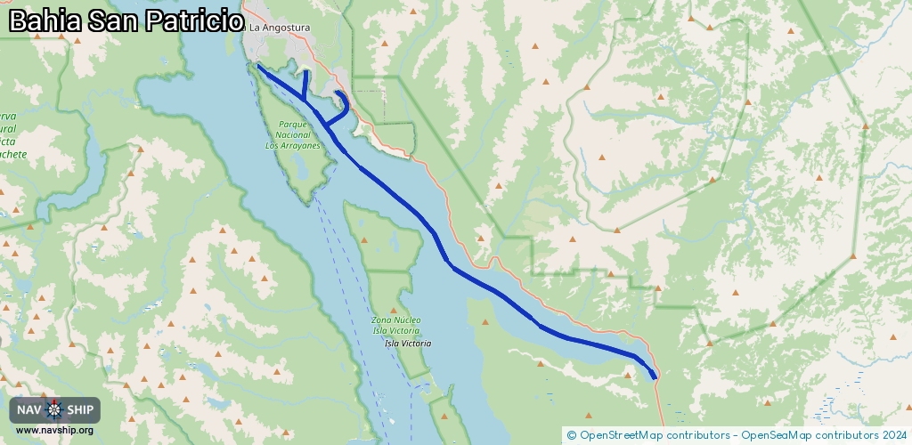
Waterway information

Kind:
Inland
Driving areas:
🇦🇷 Argentina🇨🇱 Chile
Length:
38.7 km¹
¹River kilometers or bank length recorded in NavShip, including river arms and harbor entrances.
Availability:
Completely recorded
Recent Update: 05.11.2024²
² This date indicates when an adjustment last took place in the course of the body of water
Recorded:
Locks: 0
Harbours / marinas: 3
Bridges: 0
Berths: 0
Slipways: 1
Fuelstations: 0
Route:
Please wait, loading route graphic...
Request waterway overview map with symbol legend here (Link).
Information about data associated with this body of water (4 available):
Data by OpenSeaMap (c) OSM contributors, www.openseamap.org
| # | Kind | Coordinates | Name | Information |
|---|---|---|---|---|
| 1 | Marina | -40.79994,-71.5909 | 2021-08-07T09:40:20Z | Marinas Alto Manzano |
| 2 | Marina | -40.79976,-71.59633 | 2021-08-04T14:13:41Z | |
| 3 | Marina | -40.787,-71.61925 | 2020-10-03T22:52:28Z | Cumelen Country Club |
| 4 | Slipway | -40.79977,-71.59734 | small_craft_facility | 2022-07-11T08:03:40Z |