Waterway information

Kind:
Inland
Driving areas:
🇳🇴 Norway
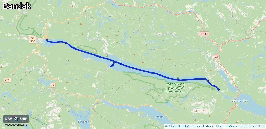
Length:
28.8 km¹
¹River kilometers or bank length recorded in NavShip, including river arms and harbor entrances.
Availability:
Completely recorded
Recent Update: 29.12.2023²
² This date indicates when an adjustment last took place in the course of the body of water
Recorded:
Locks: 0
Harbours / marinas: 5
Bridges: 0
Berths: 0
Slipways: 2
Fuelstations: 0
Route:
Please wait, loading route graphic...
Request waterway overview map with symbol legend here (Link).
Information about data associated with this body of water (7 available):
Data by OpenSeaMap (c) OSM contributors, www.openseamap.org
| # | Kind | Coordinates | Name | Information |
|---|---|---|---|---|
| 1 | Marina | 59.40787,8.18897 | 2023-05-10T08:28:56Z | Bandaksli |
| 2 | Marina | 59.44476,8.02472 | 2023-05-10T08:28:56Z | Lastein brygge |
| 3 | Marina | 59.42424,8.18802 | 2023-05-10T08:28:56Z | Lårdal brygge |
| 4 | Marina | 59.42372,8.18733 | 2019-09-21T07:36:55Z | Lårdal gjestebrygge |
| 5 | Marina | 59.38601,8.45279 | 2023-05-11T22:49:02Z | Sandodd brygge |
| 6 | Slipway | 59.445,8.02336 | small_craft_facility | 2023-05-09T14:36:59Z Dalen |
| 7 | Slipway | 59.42342,8.18653 | small_craft_facility | 2023-05-09T14:36:59Z Lårdal |