Waterway information

Kind:
Inland
Driving areas:
🇸🇪 Sweden
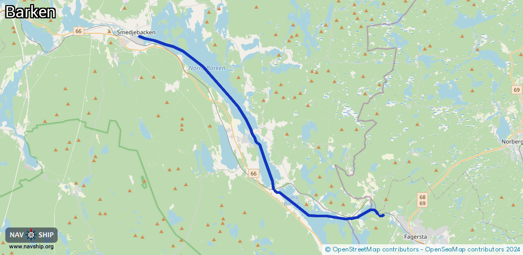
Length:
31.4 km¹
¹River kilometers or bank length recorded in NavShip, including river arms and harbor entrances.
Availability:
Completely recorded
Recent Update: 04.11.2024²
² This date indicates when an adjustment last took place in the course of the body of water
Recorded:
Locks: 5
Harbours / marinas: 3
Bridges: 0
Berths: 0
Slipways: 0
Fuelstations: 0
Route:
Please wait, loading route graphic...
Request waterway overview map with symbol legend here (Link).
Information about data associated with this body of water (3 available):
Data by OpenSeaMap (c) OSM contributors, www.openseamap.org
| # | Kind | Coordinates | Name | Information |
|---|---|---|---|---|
| 1 | Marina | 59.98355,15.81706 | 2024-10-19T16:15:34Z | |
| 2 | Marina | 60.07075,15.56457 | 2024-01-07T22:44:24Z | Söderbärkes hamn https://smedjebackensbatklubb.se |
| 3 | Marina | 60.13873,15.41797 | 2024-01-07T22:44:24Z | Smedjebackens Båtklubb https://smedjebackensbatklubb.se |
| 3 | Marina | 60.13873,15.41797 | 2024-01-07T22:44:24Z | Smedjebackens Båtklubb https://smedjebackensbatklubb.se |
| 3 | Marina | 60.13873,15.41797 | 2024-01-07T22:44:24Z | Smedjebackens Båtklubb https://smedjebackensbatklubb.se |
| 3 | Marina | 60.13873,15.41797 | 2024-01-07T22:44:24Z | Smedjebackens Båtklubb https://smedjebackensbatklubb.se |
| 3 | Marina | 60.13873,15.41797 | 2024-01-07T22:44:24Z | Smedjebackens Båtklubb https://smedjebackensbatklubb.se |
| 3 | Marina | 60.13873,15.41797 | 2024-01-07T22:44:24Z | Smedjebackens Båtklubb https://smedjebackensbatklubb.se |