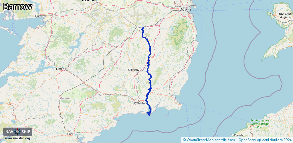
Waterway information

Kind:
Inland
Driving areas:
🌊 Atlantic Ocean🇮🇪 Ireland
Length:
150.1 km¹
¹River kilometers or bank length recorded in NavShip, including river arms and harbor entrances.
Availability:
Completely recorded
Recent Update: 09.01.2024²
² This date indicates when an adjustment last took place in the course of the body of water
Recorded:
Locks: 24
Harbours / marinas: 5
Bridges: 0
Berths: 0
Slipways: 0
Fuelstations: 0
Route:
Please wait, loading route graphic...
Request waterway overview map with symbol legend here (Link).
Information about data associated with this body of water (29 available):
Data by OpenSeaMap (c) OSM contributors, www.openseamap.org
| # | Kind | Coordinates | Name | Information |
|---|---|---|---|---|
| 1 | Marina | 52.83331,-6.93785 | 2025-06-04T22:44:17Z | |
| 2 | Marina | 52.73697,-6.97723 | 2021-11-21T16:11:26Z | |
| 3 | Marina | 52.67382,-6.97042 | 2025-06-03T20:42:41Z | |
| 4 | Marina | 52.15056,-6.99201 | 2024-12-06T18:42:12Z | Small Craft Moorings |
| 5 | Marina | 52.14991,-6.99226 | 2024-12-06T18:42:12Z | Moorings |
| 6 | Lock | 53.14104,-7.06954 | Unknown | |
| 7 | Lock | 52.99113,-6.99074 | Unknown | |
| 8 | Lock | 52.98783,-6.98507 | Unknown | |
| 9 | Lock | 52.97737,-6.97906 | Unknown | |
| 10 | Lock | 52.8967,-6.93944 | Unknown | |
| 11 | Lock | 52.86004,-6.93627 | Unknown | |
| 12 | Lock | 52.83439,-6.93825 | Unknown | |
| 13 | Lock | 52.81187,-6.95937 | Unknown | |
| 14 | Lock | 52.77687,-6.96271 | Unknown | |
| 15 | Lock | 52.74479,-6.97186 | Unknown | |
| 16 | Lock | 52.71477,-6.96039 | Unknown | |
| 17 | Lock | 52.70328,-6.96707 | Unknown | |
| 18 | Lock | 52.68126,-6.96908 | Unknown | |
| 19 | Lock | 52.66351,-6.98568 | Unknown | |
| 20 | Lock | 52.64162,-6.98573 | Unknown | |
| 21 | Lock | 52.62461,-6.97983 | Unknown | |
| 22 | Lock | 52.60578,-6.97071 | Unknown | |
| 23 | Lock | 52.59337,-6.94099 | Unknown | |
| 24 | Lock | 52.57738,-6.91918 | Unknown | |
| 25 | Lock | 52.56021,-6.91584 | Unknown | |
| 26 | Lock | 52.55343,-6.93076 | Unknown | |
| 27 | Lock | 52.53768,-6.95775 | Unknown | |
| 28 | Lock | 52.5226,-6.93405 | Unknown | |
| 29 | Lock | 52.49601,-6.93693 | Unknown |