Waterway information

Kind:
Inland
Driving areas:
🇬🇧 United Kingdom
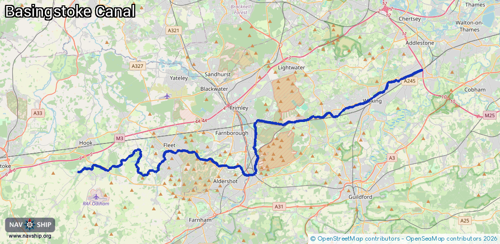
Length:
49.5 km¹
¹River kilometers or bank length recorded in NavShip, including river arms and harbor entrances.
Availability:
Completely recorded
Recent Update: 06.08.2020²
² This date indicates when an adjustment last took place in the course of the body of water
Recorded:
Locks: 18
Harbours / marinas: 0
Bridges: 0
Berths: 0
Slipways: 0
Fuelstations: 0
Route:
Please wait, loading route graphic...
Request waterway overview map with symbol legend here (Link).
Information about data associated with this body of water (18 available):
Data by OpenSeaMap (c) OSM contributors, www.openseamap.org
| # | Kind | Coordinates | Name | Information |
|---|---|---|---|---|
| 1 | Lock | 51.25836,-0.73896 | Ash Lock | |
| 2 | Lock | 51.30069,-0.69407 | Unknown | |
| 3 | Lock | 51.29985,-0.68814 | Unknown | |
| 4 | Lock | 51.29992,-0.68553 | Unknown | |
| 5 | Lock | 51.29929,-0.68122 | Unknown | |
| 6 | Lock | 51.30009,-0.67851 | Unknown | |
| 7 | Lock | 51.30098,-0.67651 | Unknown | |
| 8 | Lock | 51.30165,-0.67425 | Unknown | |
| 9 | Lock | 51.30164,-0.6713 | Unknown | |
| 10 | Lock | 51.30128,-0.66897 | Unknown | |
| 11 | Lock | 51.30157,-0.66629 | Unknown | |
| 12 | Lock | 51.30235,-0.66161 | Unknown | |
| 13 | Lock | 51.30348,-0.64792 | Unknown | |
| 14 | Lock | 51.30581,-0.62666 | Unknown | |
| 15 | Lock | 51.31298,-0.59544 | Unknown | |
| 16 | Lock | 51.34166,-0.50783 | Unknown | |
| 17 | Lock | 51.34338,-0.50035 | Unknown | |
| 18 | Lock | 51.34598,-0.49232 | Unknown |