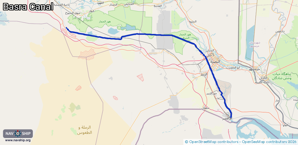
Waterway information

Kind:
Inland
Driving areas:
Other areas
Length:
198.9 km¹
¹River kilometers or bank length recorded in NavShip, including river arms and harbor entrances.
Availability:
Completely recorded
Recent Update: 23.01.2024²
² This date indicates when an adjustment last took place in the course of the body of water
Recorded:
Locks: 1
Harbours / marinas: 0
Bridges: 0
Berths: 14
Slipways: 0
Fuelstations: 0
Route:
Please wait, loading route graphic...
Request waterway overview map with symbol legend here (Link).
Information about data associated with this body of water (14 available):
Data by OpenSeaMap (c) OSM contributors, www.openseamap.org
| # | Kind | Coordinates | Name | Information |
|---|---|---|---|---|
| 1 | Berth | 30.20969,47.87259 | 2023-08-29T11:46:38Z | رصيف 14 |
| 2 | Berth | 30.20822,47.87335 | 2023-08-29T11:46:38Z | رصيف 13 |
| 3 | Berth | 30.20584,47.87573 | 2023-08-29T11:46:38Z | رصيف 12 |
| 4 | Berth | 30.20051,47.87974 | 2023-08-29T11:46:38Z | رصيف 10 |
| 5 | Berth | 30.20209,47.8785 | 2023-08-29T11:46:38Z | رصيف 11 |
| 6 | Berth | 30.1983,47.88167 | 2023-08-29T11:46:38Z | رصيف 9 |
| 7 | Berth | 30.1967,47.88294 | 2023-08-29T11:46:38Z | رصيف 8 |
| 8 | Berth | 30.19375,47.88537 | 2023-08-29T11:46:38Z | رصيف 7 |
| 9 | Berth | 30.19157,47.88714 | 2023-08-29T11:46:38Z | رصيف 6 |
| 10 | Berth | 30.18953,47.88848 | 2023-08-29T11:46:38Z | رصيف 5 |
| 11 | Berth | 30.18783,47.89028 | 2023-08-29T11:46:38Z | رصيف 4 |
| 12 | Berth | 30.18545,47.89224 | 2023-08-29T11:46:38Z | رصيف 2 |
| 13 | Berth | 30.18678,47.89117 | 2023-08-29T11:46:38Z | رصيف 3 |
| 14 | Berth | 30.18215,47.89363 | 2023-08-29T11:46:38Z | رصيف 1 |
| 14 | Berth | 30.18215,47.89363 | 2023-08-29T11:46:38Z | رصيف 1 |