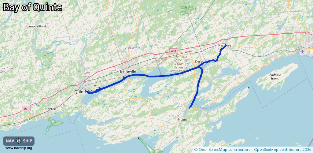
Waterway information

Kind:
Inland
Driving areas:
🇨🇦 Canada
Length:
77 km¹
¹River kilometers or bank length recorded in NavShip, including river arms and harbor entrances.
Availability:
Completely recorded
Recent Update: 14.05.2025²
² This date indicates when an adjustment last took place in the course of the body of water
Recorded:
Locks: 0
Harbours / marinas: 6
Bridges: 0
Berths: 0
Slipways: 0
Fuelstations: 0
Route:
Please wait, loading route graphic...
Request waterway overview map with symbol legend here (Link).
Information about data associated with this body of water (6 available):
Data by OpenSeaMap (c) OSM contributors, www.openseamap.org
| # | Kind | Coordinates | Name | Information |
|---|---|---|---|---|
| 1 | Marina | 44.14602,-77.40499 | 2024-01-02T15:22:52Z | Stillwater Basin |
| 2 | Marina | 44.19421,-77.04633 | 2025-05-01T18:02:21Z | |
| 3 | Marina | 44.19067,-77.05149 | 2025-05-01T18:02:21Z | |
| 4 | Marina | 44.11135,-77.51537 | 2021-08-11T21:46:10Z | |
| 5 | Marina | 44.10244,-77.52741 | 2021-08-11T21:46:10Z | CFB Trenton |
| 6 | Marina | 44.09777,-77.57363 | 2023-11-20T02:56:50Z | Trent Port Marina |