Waterway information

Kind:
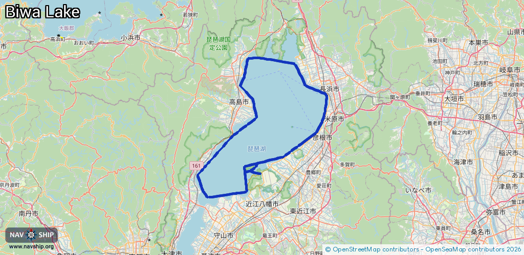
Lake
Driving areas:
🇯🇵 Japan🌊 Pacific Ocean
Length:
117.2 km¹
¹River kilometers or bank length recorded in NavShip, including river arms and harbor entrances.
Availability:
Completely recorded
Recent Update: 03.10.2025²
² This date indicates when an adjustment last took place in the course of the body of water
Recorded:
Locks: 0
Harbours / marinas: 8
Bridges: 0
Berths: 0
Slipways: 0
Fuelstations: 0
Route:
Please wait, loading route graphic...
Request waterway overview map with symbol legend here (Link).
Information about data associated with this body of water (8 available):
Data by OpenSeaMap (c) OSM contributors, www.openseamap.org
| # | Kind | Coordinates | Name | Information |
|---|---|---|---|---|
| 1 | Marina | 35.22924,136.15441 | 2015-11-04T14:59:37Z | 柳川漁港 |
| 2 | Marina | 35.28392,136.24468 | 2021-08-24T23:36:37Z | 彦根港 |
| 3 | Marina | 35.30817,136.25978 | 2021-08-24T23:36:37Z | 磯漁港 |
| 4 | Marina | 35.32934,136.26815 | 2021-08-24T23:36:37Z | 朝妻漁港 |
| 5 | Marina | 35.37214,136.26425 | 2021-08-24T23:36:37Z | 長浜港 |
| 6 | Marina | 35.1943,136.09267 | 2021-08-24T23:36:37Z | 堀切港 |
| 7 | Marina | 35.20086,136.05827 | 2021-08-24T23:36:37Z | 沖島港 |
| 8 | Marina | 35.20029,136.05709 | 2021-08-24T23:36:37Z |