Waterway information

Kind:
Inland
Driving areas:
🇨🇦 Canada🇺🇸 United States of America
Length:
8.1 km¹
¹River kilometers or bank length recorded in NavShip, including river arms and harbor entrances.
Availability:
Completely recorded
Recent Update: 04.03.2025²
² This date indicates when an adjustment last took place in the course of the body of water
Recorded:
Locks: 1
Harbours / marinas: 3
Bridges: 2
Berths: 1
Slipways: 0
Fuelstations: 0
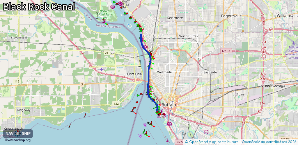
Route:
Please wait, loading route graphic...
Request waterway overview map with symbol legend here (Link).
Information about data associated with this body of water (7 available):
Data by OpenSeaMap (c) OSM contributors, www.openseamap.org
| # | Kind | Coordinates | Name | Information |
|---|---|---|---|---|
| 1 | Marina | 42.89717,-78.90169 | 2025-03-08T01:18:16Z | Buffalo Yacht Club |
| 2 | Marina | 42.93633,-78.90671 | 2025-02-14T14:28:33Z | Rich Marine Sales https://www.richmarinesales.us/ |
| 3 | Marina | 42.94223,-78.90921 | 2015-10-06T09:18:57Z | Harbor Place Marina |
| 4 | Bridge | 42.93382,-78.90527 | Unknown | Clearance height: 2025-04-14T13:20:38Z m |
| 5 | Bridge | 42.93509,-78.90699 | Unknown | Clearance height: 2025-04-14T13:20:38Z m |
| 6 | Berth | 42.8958,-78.90429 | 2018-03-07T03:51:49Z | |
| 7 | Lock | 42.93439,-78.9061 | Black Rock Lake |