Waterway information

Kind:
Inland
Driving areas:
🇩🇪 Germany
Length:
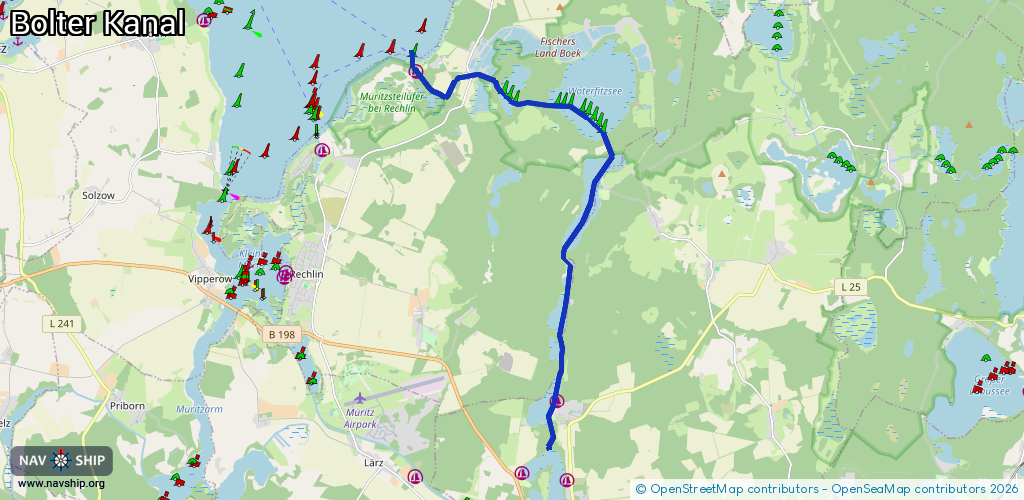
13.5 km¹
¹River kilometers or bank length recorded in NavShip, including river arms and harbor entrances.
Availability:
Completely recorded
Recent Update: 29.08.2023²
² This date indicates when an adjustment last took place in the course of the body of water
Recorded:
Locks: 0
Harbours / marinas: 2
Bridges: 0
Berths: 0
Slipways: 1
Fuelstations: 0
Route:
Please wait, loading route graphic...
Request waterway overview map with symbol legend here (Link).
Information about data associated with this body of water (3 available):
Data by OpenSeaMap (c) OSM contributors, www.openseamap.org
| # | Kind | Coordinates | Name | Information |
|---|---|---|---|---|
| 1 | Marina | 53.37191,12.76004 | 2023-11-07T00:05:54Z | Bolter Kanal Zeltplatz und Seglerzuflucht [email protected] +49 39823 2530 https://www.mueritz.com/campingplatz-bootshafen/preisliste-bootshafen/ |
| 2 | Marina | 53.30437,12.80836 | 2019-04-26T10:45:59Z | Ferienpark Mirow +49 39833 20655 |
| 3 | Slipway | 53.37284,12.75901 | small_craft_facility | 2019-09-13T18:25:09Z |