Waterway information

Kind:
Inland
Driving areas:
🇳🇱 Netherlands
Length:
8.2 km¹
¹River kilometers or bank length recorded in NavShip, including river arms and harbor entrances.
Availability:
Completely recorded
Recent Update: 16.09.2022²
² This date indicates when an adjustment last took place in the course of the body of water
Recorded:
Locks: 0
Harbours / marinas: 1
Bridges: 5
Berths: 5
Slipways: 0
Fuelstations: 0
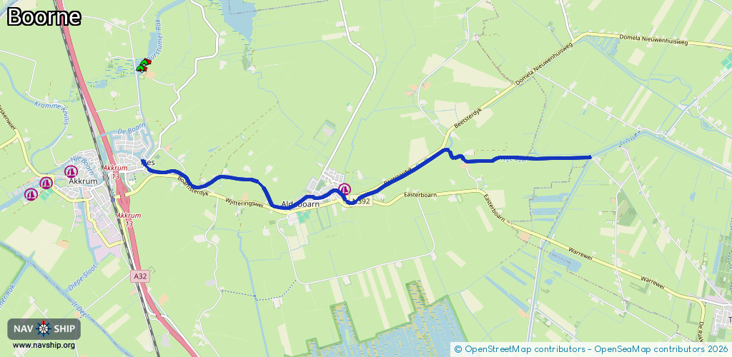
Route:
Please wait, loading route graphic...
Request waterway overview map with symbol legend here (Link).
Information about data associated with this body of water (11 available):
Data by OpenSeaMap (c) OSM contributors, www.openseamap.org
| # | Kind | Coordinates | Name | Information |
|---|---|---|---|---|
| 1 | Marina | 53.04893,5.89898 | 2025-05-23T14:12:41Z | Swettehaven Aldeboarn |
| 2 | Bridge | 53.04753,5.89905 | 16.8 | Clearance height: 2018-07-27T08:12:49Z m Maximum passage width: 3.4 m Movable bridge (e.g. lifting bridge or drawbridge) fixed |
| 3 | Bridge | 53.04818,5.89484 | 5.5 | Clearance height: 2018-08-09T16:11:45Z m Maximum passage width: 0.9 m Movable bridge (e.g. lifting bridge or drawbridge) swing |
| 4 | Bridge | 53.04783,5.89346 | 5.9 | Clearance height: 2021-04-08T14:32:12Z m Maximum passage width: 1.3 m Movable bridge (e.g. lifting bridge or drawbridge) swing |
| 5 | Bridge | 53.04766,5.89219 | 6 | Clearance height: 2018-08-09T16:11:45Z m Maximum passage width: 0.9 m Movable bridge (e.g. lifting bridge or drawbridge) swing |
| 6 | Bridge | 53.05245,5.85113 | 6 | Clearance height: 2021-03-17T16:31:25Z m Maximum passage width: 0.8 m Movable bridge (e.g. lifting bridge or drawbridge) opening |
| 7 | Berth | 53.05293,5.93356 | 2023-11-21T00:33:16Z | PR63 |
| 8 | Berth | 53.04884,5.89651 | 2018-08-25T07:00:03Z | Gemeente Oldeboarn |
| 9 | Berth | 53.05194,5.85168 | 2018-08-25T07:36:50Z | |
| 10 | Berth | 53.0523,5.85151 | 2018-11-14T09:32:13Z | |
| 11 | Berth | 53.05322,5.85074 | 2018-11-14T09:31:50Z |