Waterway information

Kind:
Lower
Driving areas:
🇩🇪 Germany
Length:
3.8 km¹
¹River kilometers or bank length recorded in NavShip, including river arms and harbor entrances.
Availability:
Completely recorded
Recent Update: 03.01.2024²
² This date indicates when an adjustment last took place in the course of the body of water
Recorded:
Locks: 0
Harbours / marinas: 2
Bridges: 0
Berths: 0
Slipways: 0
Fuelstations: 0
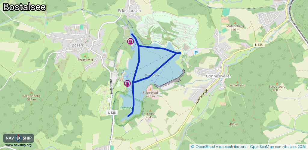
Route:
Please wait, loading route graphic...
Request waterway overview map with symbol legend here (Link).
Information about data associated with this body of water (2 available):
Data by OpenSeaMap (c) OSM contributors, www.openseamap.org
| # | Kind | Coordinates | Name | Information |
|---|---|---|---|---|
| 1 | Marina | 49.57148,7.06662 | 2026-01-01T20:01:38Z | Seglerbasis (Landesverband Saarländischer Segler e.V.) https://www.lvss.de/ |
| 2 | Marina | 49.56352,7.06551 | 2015-08-03T18:22:06Z |