Waterway information

Kind:
Inland
Driving areas:
🇮🇹 Italy🌊 Sea Mediterranean
Length:
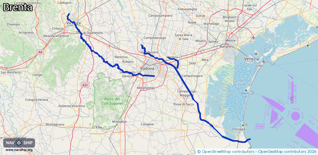
124.7 km¹
¹River kilometers or bank length recorded in NavShip, including river arms and harbor entrances.
Availability:
Completely recorded
Recent Update: 08.04.2025²
² This date indicates when an adjustment last took place in the course of the body of water
Recorded:
Locks: 0
Harbours / marinas: 4
Bridges: 0
Berths: 0
Slipways: 1
Fuelstations: 0
Route:
Please wait, loading route graphic...
Request waterway overview map with symbol legend here (Link).
Information about data associated with this body of water (5 available):
Data by OpenSeaMap (c) OSM contributors, www.openseamap.org
| # | Kind | Coordinates | Name | Information |
|---|---|---|---|---|
| 1 | Marina | 45.18262,12.26932 | 2023-11-06T23:55:14Z | Club Nautico Marina di Brondolo [email protected] +39 041 490950 https://www.marinadibrondolo.it/ |
| 2 | Marina | 45.1778,12.28431 | 2023-11-06T23:55:05Z | Approdo turistico BrentaMare [email protected] https://www.isolaverde.net/brentamare/index.html |
| 3 | Marina | 45.1813,12.30673 | 2025-10-06T07:38:36Z | Darsena Oasis |
| 4 | Marina | 45.40855,12.0058 | 2020-09-24T20:29:51Z | Antica Pescheria di Stra |
| 5 | Slipway | 45.17781,12.28479 | small_craft_facility | 2013-05-08T16:27:40Z |