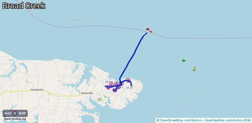
Waterway information

Kind:
Inland
Driving areas:
🌊 Atlantic Ocean🇺🇸 United States of America
Length:
6.2 km¹
¹River kilometers or bank length recorded in NavShip, including river arms and harbor entrances.
Availability:
Completely recorded
Recent Update: 11.12.2023²
² This date indicates when an adjustment last took place in the course of the body of water
Recorded:
Locks: 0
Harbours / marinas: 7
Bridges: 0
Berths: 0
Slipways: 0
Fuelstations: 0
Route:
Please wait, loading route graphic...
Request waterway overview map with symbol legend here (Link).
Information about data associated with this body of water (7 available):
Data by OpenSeaMap (c) OSM contributors, www.openseamap.org
| # | Kind | Coordinates | Name | Information |
|---|---|---|---|---|
| 1 | Marina | 37.56019,-76.31285 | 2022-08-16T01:24:56Z | Regatta Point Yachting Center |
| 2 | Marina | 37.55825,-76.31483 | 2022-08-16T01:24:56Z | Nomad Norview Marina |
| 3 | Marina | 37.55999,-76.3163 | 2022-08-16T01:24:56Z | Waldens Marina |
| 4 | Marina | 37.55941,-76.31987 | 2022-08-16T01:24:56Z | True North Boatworks |
| 5 | Marina | 37.55808,-76.32203 | 2022-08-16T01:24:56Z | Chesapeake Cove Marina |
| 6 | Marina | 37.56187,-76.30813 | 2022-06-27T17:37:18Z | Stingray Point Marina http://www.stingraypointmarina.com/ |
| 7 | Marina | 37.55649,-76.31753 | 2022-08-16T01:24:56Z | Deltaville Yachting Center |