Waterway information

Kind:
Inland
Driving areas:
🇨🇦 Canada🇺🇸 United States of America
Length:
5.4 km¹
¹River kilometers or bank length recorded in NavShip, including river arms and harbor entrances.
Availability:
Completely recorded
Recent Update: 26.02.2024²
² This date indicates when an adjustment last took place in the course of the body of water
Recorded:
Locks: 0
Harbours / marinas: 5
Bridges: 0
Berths: 1
Slipways: 2
Fuelstations: 0
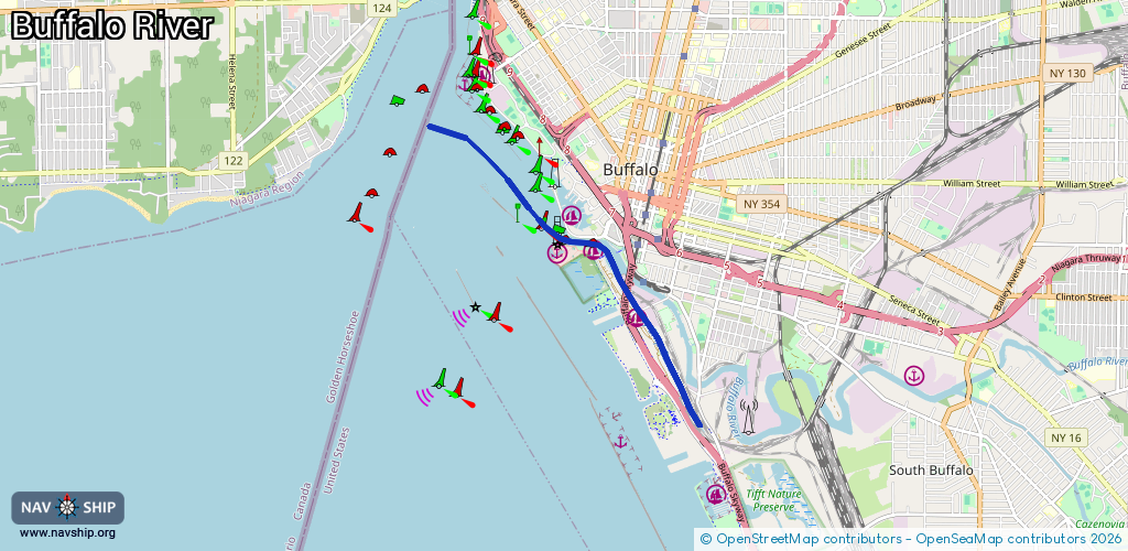
Route:
Please wait, loading route graphic...
Request waterway overview map with symbol legend here (Link).
Information about data associated with this body of water (8 available):
Data by OpenSeaMap (c) OSM contributors, www.openseamap.org
| # | Kind | Coordinates | Name | Information |
|---|---|---|---|---|
| 1 | Marina | 42.88096,-78.88749 | 2021-02-21T14:44:06Z | Erie Basin Marina |
| 2 | Marina | 42.8768,-78.88986 | 2023-10-17T03:10:42Z | Buffalo Coast Guard Slip |
| 3 | Marina | 42.87715,-78.88395 | 2022-06-26T12:52:06Z | Cazenovia Community Boating Center https://www.sail-buffalo.org/ |
| 4 | Marina | 42.8695,-78.87718 | 2022-06-25T18:57:06Z | Skyway Marina |
| 5 | Marina | 42.8493,-78.86514 | 2021-07-21T22:38:30Z | NFTA Small Boat Harbor |
| 6 | Slipway | 42.87206,-78.87925 | Unknown | 2022-10-04T22:13:55Z |
| 7 | Slipway | 42.87205,-78.87929 | small_craft_facility | 2022-06-26T11:59:59Z |
| 8 | Berth | 42.8489,-78.86467 | 2015-10-06T11:03:04Z |