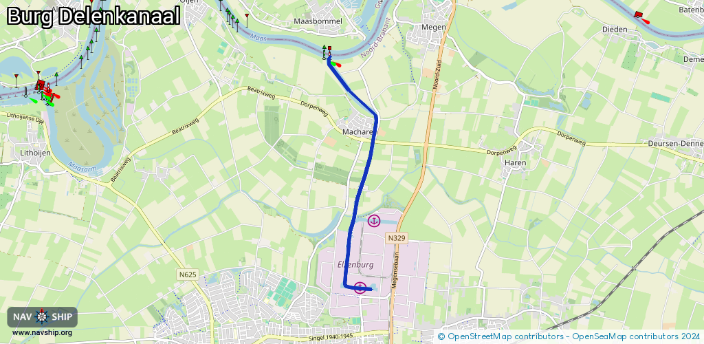
Waterway information

Kind:
Inland
Driving areas:
🇳🇱 Netherlands
Length:
4.8 km¹
¹River kilometers or bank length recorded in NavShip, including river arms and harbor entrances.
Availability:
Completely recorded
Recent Update: 22.06.2023²
² This date indicates when an adjustment last took place in the course of the body of water
Recorded:
Locks: 1
Harbours / marinas: 3
Bridges: 1
Berths: 0
Slipways: 0
Fuelstations: 0
Route:
Please wait, loading route graphic...
Request waterway overview map with symbol legend here (Link).
Information about data associated with this body of water (5 available):
Data by OpenSeaMap (c) OSM contributors, www.openseamap.org
| # | Kind | Coordinates | Name | Information |
|---|---|---|---|---|
| 1 | Marina | 51.7805,5.5457 | 2019-01-19T16:42:56Z | Burgemeester Jansenhaven |
| 2 | Marina | 51.78183,5.54226 | 2025-06-07T15:44:35Z | Inland Terminal Oss [email protected] +31 413 388038 https://www.vanberkellogistics.nl |
| 3 | Marina | 51.79065,5.5483 | 2020-08-02T06:40:42Z | Burgemeester Van Veldhuizenhaven |
| 4 | Bridge | 51.80297,5.54796 | 14 | Clearance height: 2022-11-04T12:37:56Z m Maximum passage width: 0.3 m Movable bridge (e.g. lifting bridge or drawbridge) opening on telephone demand, Jan 1,Dec 25,Dec 26 off |
| 5 | Lock | 51.8049,5.54841 | Unknown |