Waterway information

Kind:
Inland
Driving areas:
🌊 Atlantic Ocean🇺🇸 United States of America
Length:
17.4 km¹
¹River kilometers or bank length recorded in NavShip, including river arms and harbor entrances.
Availability:
Completely recorded
Recent Update: 01.04.2025²
² This date indicates when an adjustment last took place in the course of the body of water
Recorded:
Locks: 0
Harbours / marinas: 4
Bridges: 0
Berths: 0
Slipways: 0
Fuelstations: 0
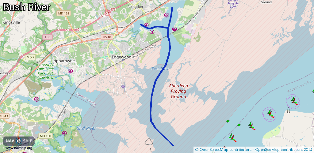
Route:
Please wait, loading route graphic...
Request waterway overview map with symbol legend here (Link).
Information about data associated with this body of water (4 available):
Data by OpenSeaMap (c) OSM contributors, www.openseamap.org
| # | Kind | Coordinates | Name | Information |
|---|---|---|---|---|
| 1 | Marina | 39.44033,-76.26057 | 2025-12-05T04:29:17Z | Flying Point Marina +1-410-676-7311 https://flyingpointmarina.com/ |
| 2 | Marina | 39.44619,-76.26652 | 2020-05-19T21:33:26Z | Otter Point Yacht Club http://otterpointyachtclub.com/ |
| 3 | Marina | 39.44289,-76.23532 | 2020-05-19T21:33:26Z | Gabler's Shore Marina |
| 4 | Marina | 39.45464,-76.24443 | 2020-05-19T21:33:26Z | Bush River Yacht Club +1 410 676 1122 http://www.bushriveryachtclub.org/ |