Waterway information

Kind:
Inland
Driving areas:
🌊 Atlantic Ocean🇺🇸 United States of America
Length:
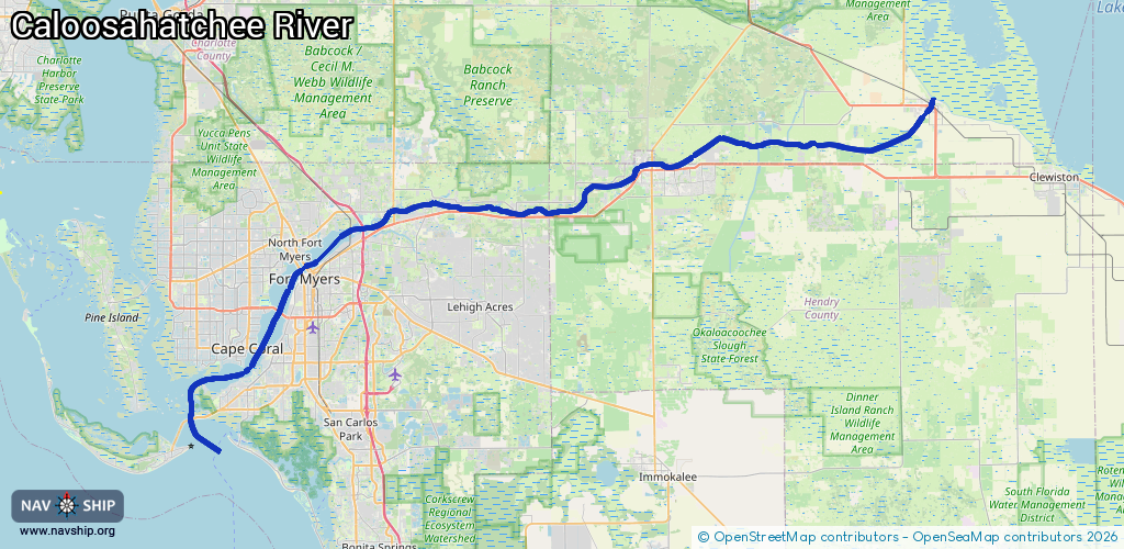
121 km¹
¹River kilometers or bank length recorded in NavShip, including river arms and harbor entrances.
Availability:
Completely recorded
Recent Update: 08.08.2025²
² This date indicates when an adjustment last took place in the course of the body of water
Recorded:
Locks: 2
Harbours / marinas: 4
Bridges: 0
Berths: 0
Slipways: 0
Fuelstations: 0
Route:
Please wait, loading route graphic...
Request waterway overview map with symbol legend here (Link).
Information about data associated with this body of water (6 available):
Data by OpenSeaMap (c) OSM contributors, www.openseamap.org
| # | Kind | Coordinates | Name | Information |
|---|---|---|---|---|
| 1 | Marina | 26.64746,-81.86977 | 2025-11-08T16:26:20Z | City of Fort Myers Yacht Basin +1-239-321-7080 |
| 2 | Marina | 26.54284,-81.95145 | 2022-10-05T07:56:18Z | Cape Coral Yacht Club |
| 3 | Marina | 26.54389,-81.95068 | 2020-05-19T23:08:03Z | |
| 4 | Marina | 26.51692,-81.99924 | 2022-09-15T19:06:01Z | Shell Point Marina |
| 5 | Lock | 26.78927,-81.30471 | Unknown | |
| 6 | Lock | 26.72175,-81.6939 | Unknown |