Waterway information

Kind:
Inland
Driving areas:
🇺🇸 United States of America
Length:
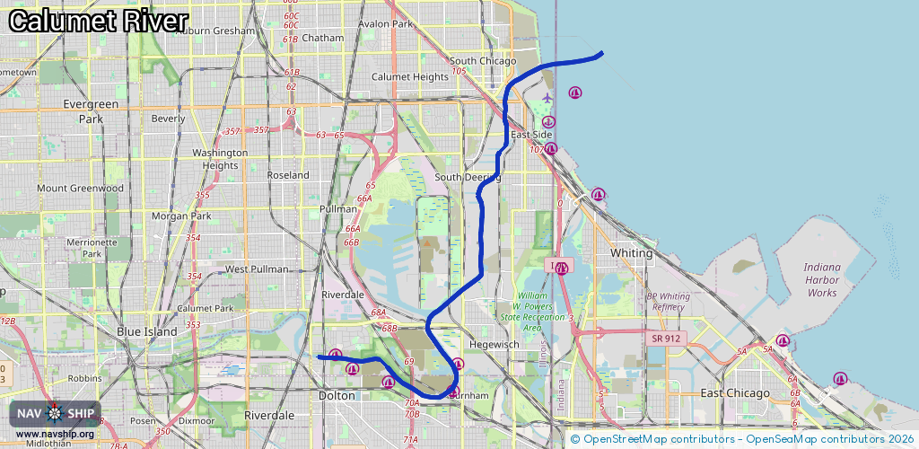
19.2 km¹
¹River kilometers or bank length recorded in NavShip, including river arms and harbor entrances.
Availability:
Completely recorded
Recent Update: 01.04.2025²
² This date indicates when an adjustment last took place in the course of the body of water
Recorded:
Locks: 1
Harbours / marinas: 5
Bridges: 0
Berths: 0
Slipways: 1
Fuelstations: 0
Route:
Please wait, loading route graphic...
Request waterway overview map with symbol legend here (Link).
Information about data associated with this body of water (7 available):
Data by OpenSeaMap (c) OSM contributors, www.openseamap.org
| # | Kind | Coordinates | Name | Information |
|---|---|---|---|---|
| 1 | Marina | 41.6504,-87.60768 | 2023-05-24T22:16:35Z | Chicago's Finest Marina |
| 2 | Marina | 41.64699,-87.60133 | 2023-06-20T02:43:54Z | Pier 11 Marina |
| 3 | Marina | 41.64261,-87.587 | 2024-08-19T00:19:47Z | Marine Services Corporation |
| 4 | Marina | 41.64066,-87.5628 | 2023-08-06T08:09:43Z | Cal-Side Marina |
| 5 | Marina | 41.64754,-87.56156 | 2024-08-21T21:48:27Z | Sunset Bay Marina |
| 6 | Slipway | 41.64188,-87.58935 | Unknown | 2024-08-19T00:19:47Z |
| 7 | Lock | 41.65159,-87.56709 | Thomas J O Brien Lock and Dam |