Waterway information

Kind:
Inland
Driving areas:
🌊 Atlantic Ocean🇺🇸 United States of America
Length:
1.5 km¹
¹River kilometers or bank length recorded in NavShip, including river arms and harbor entrances.
Availability:
Completely recorded
Recent Update: 18.01.2024²
² This date indicates when an adjustment last took place in the course of the body of water
Recorded:
Locks: 0
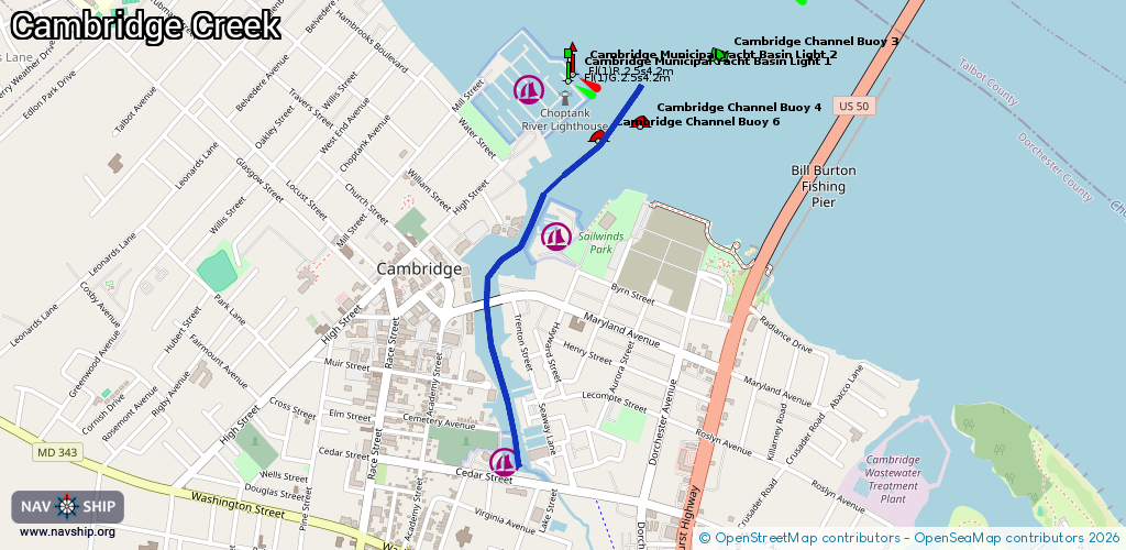
Harbours / marinas: 2
Bridges: 3
Berths: 0
Slipways: 0
Fuelstations: 0
Route:
Please wait, loading route graphic...
Request waterway overview map with symbol legend here (Link).
Information about data associated with this body of water (5 available):
Data by OpenSeaMap (c) OSM contributors, www.openseamap.org
| # | Kind | Coordinates | Name | Information |
|---|---|---|---|---|
| 1 | Marina | 38.57232,-76.07079 | 2024-10-29T13:14:21Z | |
| 2 | Marina | 38.56572,-76.07323 | 2021-04-24T13:57:39Z | Generation III Marina [email protected] +1 410 228 2520 https://www.generation3marina.com/ |
| 3 | Bridge | 38.57032,-76.07401 | Unknown | Clearance height: 2026-02-04T06:01:03Z m Movable bridge (e.g. lifting bridge or drawbridge) fixed |
| 4 | Bridge | 38.57038,-76.07372 | 15.2 | Clearance height: 2026-02-04T06:01:03Z m Maximum passage width: 2.4 m Movable bridge (e.g. lifting bridge or drawbridge) bascule |
| 5 | Bridge | 38.57045,-76.07337 | Unknown | Clearance height: 2026-02-04T06:01:03Z m Movable bridge (e.g. lifting bridge or drawbridge) fixed |