Waterway information

Kind:
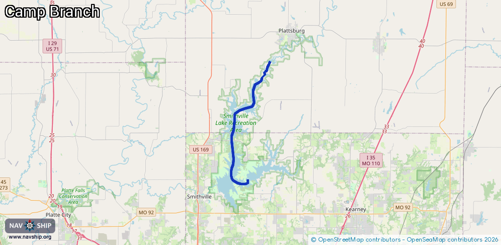
Inland
Driving areas:
🇺🇸 United States of America
Length:
19.1 km¹
¹River kilometers or bank length recorded in NavShip, including river arms and harbor entrances.
Availability:
Completely recorded
Recent Update: 01.04.2025²
² This date indicates when an adjustment last took place in the course of the body of water
Recorded:
Locks: 0
Harbours / marinas: 3
Bridges: 0
Berths: 0
Slipways: 0
Fuelstations: 2
Route:
Please wait, loading route graphic...
Request waterway overview map with symbol legend here (Link).
Information about data associated with this body of water (5 available):
Data by OpenSeaMap (c) OSM contributors, www.openseamap.org
| # | Kind | Coordinates | Name | Information |
|---|---|---|---|---|
| 1 | Marina | 39.43134,-94.52669 | 2025-02-25T02:05:27Z | Sailboat Cove Marina |
| 2 | Marina | 39.4148,-94.54062 | 2021-01-12T00:47:33Z | Paradise Pointe Marina https://www.claycountymo.gov/departments/public-services/parks/marinas |
| 3 | Marina | 39.40517,-94.51589 | 2025-02-25T02:05:27Z | Camp Branch Marina |
| 4 | Fuel station | 39.41467,-94.54118 | 2025-02-19T23:12:14Z | Paradise Pointe Marina |
| 5 | Fuel station | 39.40497,-94.51626 | 2025-02-25T02:05:27Z | Camp Branch Marina |