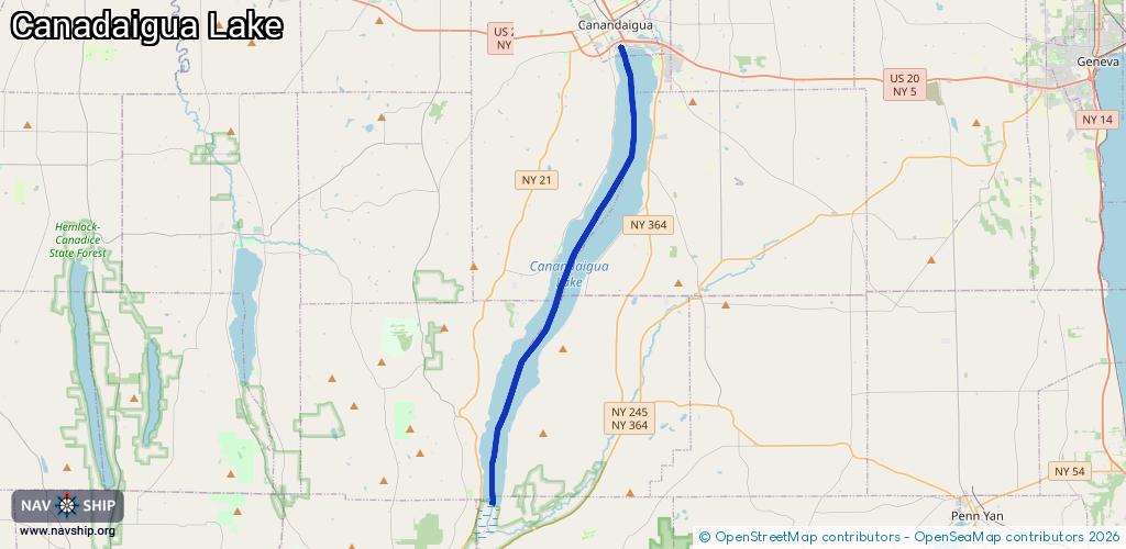
Waterway information

Kind:
Inland
Driving areas:
🇺🇸 United States of America
Length:
25.2 km¹
¹River kilometers or bank length recorded in NavShip, including river arms and harbor entrances.
Availability:
Completely recorded
Recent Update: 02.06.2024²
² This date indicates when an adjustment last took place in the course of the body of water
Recorded:
Locks: 0
Harbours / marinas: 4
Bridges: 0
Berths: 0
Slipways: 0
Fuelstations: 0
Route:
Please wait, loading route graphic...
Request waterway overview map with symbol legend here (Link).
Information about data associated with this body of water (4 available):
Data by OpenSeaMap (c) OSM contributors, www.openseamap.org
| # | Kind | Coordinates | Name | Information |
|---|---|---|---|---|
| 1 | Marina | 42.87546,-77.27213 | 2024-05-24T14:35:23Z | Seager Marine |
| 2 | Marina | 42.87458,-77.27294 | 2024-05-24T14:35:23Z | Sutter's |
| 3 | Marina | 42.87662,-77.27569 | 2025-03-04T00:33:42Z | Canandaigua Lake State Marine Park +1 585-394-9420 https://parks.ny.gov/parks/3/details.aspx |
| 4 | Marina | 42.87951,-77.27735 | 2024-05-24T14:35:23Z | Seager Marine |