Waterway information

Kind:
Inland
Driving areas:
🇦🇷 Argentina🇨🇱 Chile
Length:
200.4 km¹
¹River kilometers or bank length recorded in NavShip, including river arms and harbor entrances.
Availability:
Completely recorded
Recent Update: 06.12.2024²
² This date indicates when an adjustment last took place in the course of the body of water
Recorded:
Locks: 0
Harbours / marinas: 9
Bridges: 0
Berths: 2
Slipways: 0
Fuelstations: 0
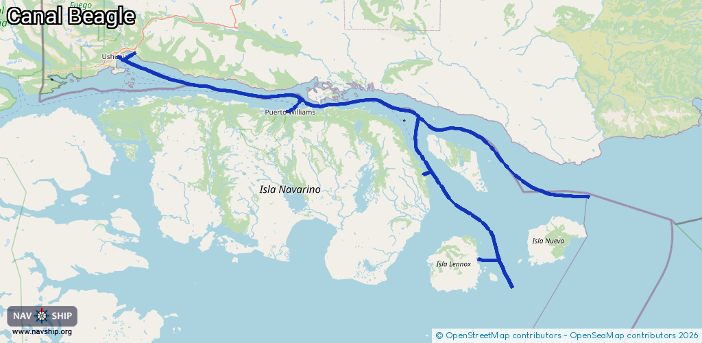
Route:
Please wait, loading route graphic...
Request waterway overview map with symbol legend here (Link).
Information about data associated with this body of water (11 available):
Data by OpenSeaMap (c) OSM contributors, www.openseamap.org
| # | Kind | Coordinates | Name | Information |
|---|---|---|---|---|
| 1 | Marina | -54.9351,-67.61822 | 2020-08-03T18:51:36Z | Club de Yates Micalvi |
| 2 | Marina | -54.93212,-67.59665 | 2024-01-13T21:50:04Z | Puerto Williams |
| 3 | Marina | -55.08193,-67.07385 | 2025-07-22T01:33:57Z | Puerto Toro |
| 4 | Marina | -54.79891,-68.2284 | 2024-11-14T17:40:14Z | Shimawaia club de kayak [email protected] |
| 5 | Marina | -54.81386,-68.30652 | 2020-08-31T17:23:41Z | Afasyn |
| 6 | Marina | -54.81382,-68.30635 | 2023-11-28T16:48:00Z | Muelle AFASyN |
| 7 | Marina | -54.80788,-68.30222 | 2020-08-31T17:23:41Z | Muelle Turístico |
| 8 | Marina | -54.8147,-68.30734 | 2024-11-14T17:40:14Z | AFASYN https://afasyn.com/ |
| 9 | Marina | -54.80513,-68.28906 | 2020-08-31T17:23:41Z | Terminal Orión |
| 10 | Berth | -55.07496,-67.0744 | 2016-01-13T17:20:37Z | Puerto Toro small_craft |
| 11 | Berth | -55.27053,-66.85588 | 2016-01-13T09:22:28Z | Caleta Lennox Norte small_craft |