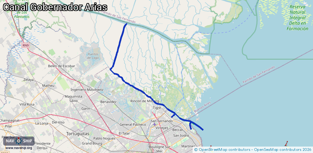
Waterway information

Kind:
Inland
Driving areas:
🇦🇷 Argentina🌊 Atlantic Ocean
Length:
36.4 km¹
¹River kilometers or bank length recorded in NavShip, including river arms and harbor entrances.
Availability:
Completely recorded
Recent Update: 10.04.2025²
² This date indicates when an adjustment last took place in the course of the body of water
Recorded:
Locks: 0
Harbours / marinas: 3
Bridges: 0
Berths: 0
Slipways: 2
Fuelstations: 0
Route:
Please wait, loading route graphic...
Request waterway overview map with symbol legend here (Link).
Information about data associated with this body of water (5 available):
Data by OpenSeaMap (c) OSM contributors, www.openseamap.org
| # | Kind | Coordinates | Name | Information |
|---|---|---|---|---|
| 1 | Marina | -34.45717,-58.507 | 2025-09-25T20:17:30Z | Club Náutico Buchardo |
| 2 | Marina | -34.42574,-58.55836 | 2022-08-06T06:01:41Z | |
| 3 | Marina | -34.44071,-58.55003 | 2022-10-08T22:44:55Z | Yatch Club Argentina |
| 4 | Slipway | -34.41433,-58.58289 | small_craft_facility | 2025-01-18T05:31:34Z Rowing Club Argentino |
| 5 | Slipway | -34.41494,-58.58124 | small_craft_facility | 2025-01-18T05:31:34Z Tigre Boat Club |