Waterway information

Kind:
Inland
Driving areas:
🇬🇧 United Kingdom
Length:
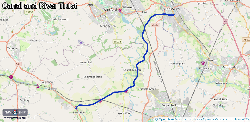
15.8 km¹
¹River kilometers or bank length recorded in NavShip, including river arms and harbor entrances.
Availability:
Completely recorded
Recent Update: 04.03.2025²
² This date indicates when an adjustment last took place in the course of the body of water
Recorded:
Locks: 4
Harbours / marinas: 3
Bridges: 0
Berths: 0
Slipways: 0
Fuelstations: 0
Route:
Please wait, loading route graphic...
Request waterway overview map with symbol legend here (Link).
Information about data associated with this body of water (3 available):
Data by OpenSeaMap (c) OSM contributors, www.openseamap.org
| # | Kind | Coordinates | Name | Information |
|---|---|---|---|---|
| 1 | Marina | 53.10922,-2.57859 | 2023-06-12T10:35:22Z | Barbridge Marina |
| 2 | Marina | 53.11502,-2.5459 | 2023-06-12T10:34:57Z | Venetian Marina https://www.venetianmarina.co.uk/ |
| 3 | Marina | 53.12305,-2.50829 | 2023-10-24T11:44:56Z | Church Minshull Aqueduct Marina https://www.aqueductmarina.co.uk/ |
| 3 | Marina | 53.12305,-2.50829 | 2023-10-24T11:44:56Z | Church Minshull Aqueduct Marina https://www.aqueductmarina.co.uk/ |
| 3 | Marina | 53.12305,-2.50829 | 2023-10-24T11:44:56Z | Church Minshull Aqueduct Marina https://www.aqueductmarina.co.uk/ |
| 3 | Marina | 53.12305,-2.50829 | 2023-10-24T11:44:56Z | Church Minshull Aqueduct Marina https://www.aqueductmarina.co.uk/ |
| 3 | Marina | 53.12305,-2.50829 | 2023-10-24T11:44:56Z | Church Minshull Aqueduct Marina https://www.aqueductmarina.co.uk/ |