Waterway information

Kind:
Inland
Driving areas:
🇫🇷 France🌊 Sea Mediterranean
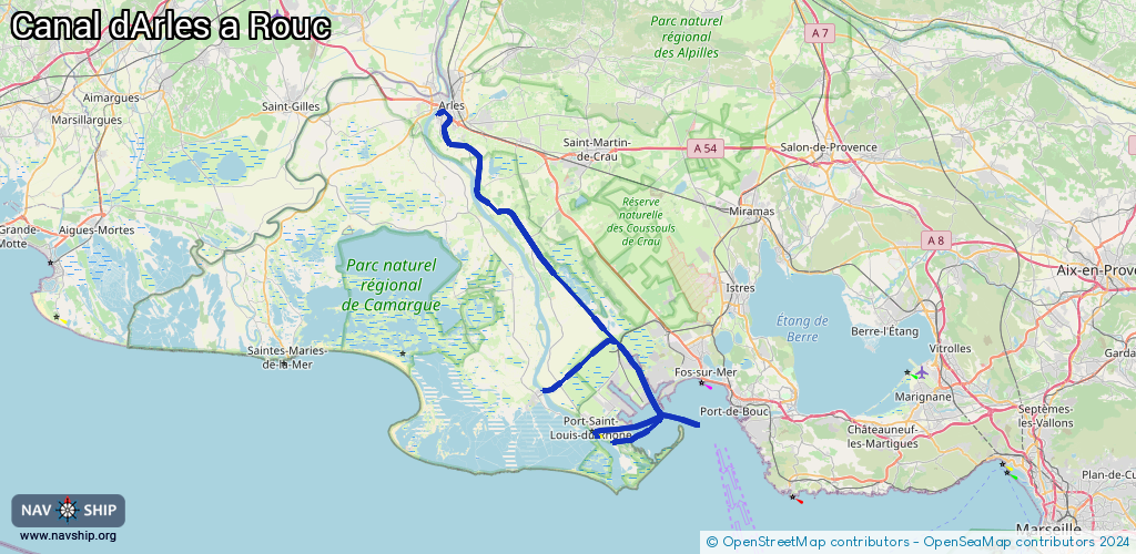
Length:
67.8 km¹
¹River kilometers or bank length recorded in NavShip, including river arms and harbor entrances.
Availability:
Completely recorded
Recent Update: 24.09.2025²
² This date indicates when an adjustment last took place in the course of the body of water
Recorded:
Locks: 3
Harbours / marinas: 5
Bridges: 0
Berths: 0
Slipways: 1
Fuelstations: 0
Route:
Please wait, loading route graphic...
Request waterway overview map with symbol legend here (Link).
Information about data associated with this body of water (9 available):
Data by OpenSeaMap (c) OSM contributors, www.openseamap.org
| # | Kind | Coordinates | Name | Information |
|---|---|---|---|---|
| 1 | Marina | 43.38997,4.85254 | 2025-02-13T15:23:55Z | |
| 2 | Marina | 43.38994,4.8532 | 2021-10-28T14:42:32Z | |
| 3 | Marina | 43.38808,4.85284 | 2025-11-25T20:30:14Z | Base Nautique Municipale |
| 4 | Marina | 43.38813,4.85002 | 2021-10-28T14:42:32Z | Port - Abri |
| 5 | Marina | 43.37584,4.83162 | 2015-08-15T18:50:35Z | Port Napoléon [email protected] +33 4 42 48 41 21 |
| 6 | Slipway | 43.37626,4.8343 | small_craft_facility | 2013-08-20T15:00:06Z |
| 7 | Lock | 43.38344,4.8085 | Unknown | |
| 8 | Lock | 43.6717,4.6169 | Unknown | |
| 9 | Lock | 43.42895,4.7647 | Unknown |