Waterway information

Kind:
Lower
Driving areas:
🇫🇷 France
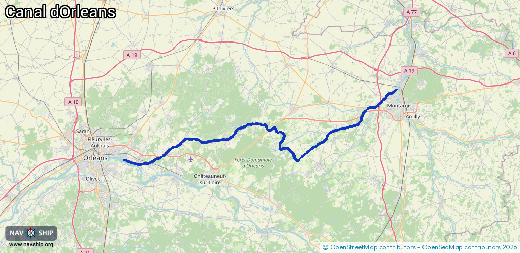
Length:
73.3 km¹
¹River kilometers or bank length recorded in NavShip, including river arms and harbor entrances.
Availability:
Completely recorded
Recent Update: 04.03.2025²
² This date indicates when an adjustment last took place in the course of the body of water
Recorded:
Locks: 18
Harbours / marinas: 0
Bridges: 0
Berths: 0
Slipways: 0
Fuelstations: 0
Route:
Please wait, loading route graphic...
Request waterway overview map with symbol legend here (Link).
Information about data associated with this body of water (18 available):
Data by OpenSeaMap (c) OSM contributors, www.openseamap.org
| # | Kind | Coordinates | Name | Information |
|---|---|---|---|---|
| 1 | Lock | 48.02032,2.70811 | Unknown | |
| 2 | Lock | 47.99323,2.64727 | Unknown | |
| 3 | Lock | 47.97315,2.62661 | Unknown | |
| 4 | Lock | 47.94805,2.54187 | Unknown | |
| 5 | Lock | 47.93116,2.52156 | Unknown | |
| 6 | Lock | 47.92307,2.50048 | Unknown | |
| 7 | Lock | 47.91523,2.48633 | Unknown | |
| 8 | Lock | 47.9107,2.47719 | Unknown | |
| 9 | Lock | 47.90392,2.46436 | Unknown | |
| 10 | Lock | 47.89712,2.456 | Unknown | |
| 11 | Lock | 47.89772,2.45446 | Unknown | |
| 12 | Lock | 47.90603,2.44538 | Unknown | |
| 13 | Lock | 47.9555,2.29431 | Unknown | |
| 14 | Lock | 47.9446,2.28335 | Unknown | |
| 15 | Lock | 47.93431,2.22731 | Unknown | |
| 16 | Lock | 47.93057,2.19752 | Unknown | |
| 17 | Lock | 47.91489,2.10349 | Unknown | |
| 18 | Lock | 47.89897,1.9857 | Unknown |